Saturday morning we decided to hike up the lower Red Creek Trail in Dolly Sods and bushwhack to a large waterfall. Michael and I been to Dolly Sods a lot, but mostly to the northern part of the wilderness area. We attempted the Red Creek trail from Laneville just once in 2006 the first year we lived here. Since we were new to the Mid-Atlantic, we really didn't understand the general climate of that area of West Virginia. We went in March, because, you know, it was spring (not really). Crossing Red Creek (which, anywhere west of the Appalachians would be called a "river"), swollen with snow, remains one of the sketchiest things I've done in the woods. We've learned so much since then, but we just hadn't made it around to revisiting that part of Dolly Sods.
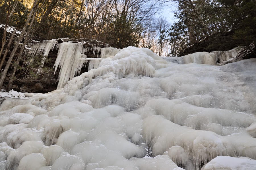
Red Creek cuts a deep, rhododendron-filled canyon through the plateau containing Dolly Sods and Roaring Plains. The area is rugged and remote. It was bright and cold when we arrived at the Laneville trailhead Saturday morning with about an inch of snow on the ground. The trail basically follows the south bank of Red Creek, which was partially to completely frozen. After a couple of miles, we paused for lunch next to one of the larger side streams. After eating, we left the trail and bushwhacked up to a large waterfall. We crossed the frozen stream, fought our way through the rhododendrons, crossed the ice several more times and fought our way through more rhododendrons. Did I mention the rhododendrons? The entire creek was filled with beautiful ice formations. The reward for the effort: a spectacular 50-foot tall frozen waterfall.
We returned to the cars the way we came, fighting our way down the creek to the trail and then hiking out along Red Creek. I'm glad Michael and I finally returned to the area and really glad we got to explore it with great friends. Tomorrow, I'll post about our hike up into the northern part of Dolly Sods.


Another view of Red Creek.
No comments:
Post a Comment