We are in Coralville, IA tonight, after about 60 miles yesterday and 75 today. Yesterday, we rode from Altoona, IA to Grinnell, IA. The route was hillier than the day before, but nothing as bad as the first two days. A lot of people really struggled with the end of the route because the hilliest section was there. Grinnell is home to Grinnell College, which graciously opened it's lawns to thousands of cyclists for camping. A tent city filled most of the open spaces on campus, but our group managed to find a relatively quiet spot (or at least it seemed that way until the train came right through the middle of campus in the night). Grinnell College also opened their dining hall for anyone who wanted to eat there. I have to say, my memories of campus food in college do not include edamame succotash and artisan bread, but that was the type of food that is served at Grinnell. After a week of eating (very good) fair food, fresh vegetables were a nice change.
Today's ride started out flat, but with a headwind. RAGBRAI's route always goes from west to east because the prevailing winds in Iowa in the summer are out of the west. For the last two days, those prevailing winds were absent, leaving us with cross and headwinds. SSW Spouse and I took turns in front, pulling for each other, so the wind wasn't too bad. We stopped for lunch, pie, ice cream, and lemonade. I can't say that we've lacked for good food this week. The only challenge at this point is that my legs need a recovery day. They aren't sore, but they are pretty tired and they are tired in the morning.
Tomorrow is the last day, which will end with us dipping our front wheels in the Mississippi River in Davenport.
Friday, July 29, 2011
Wednesday, July 27, 2011
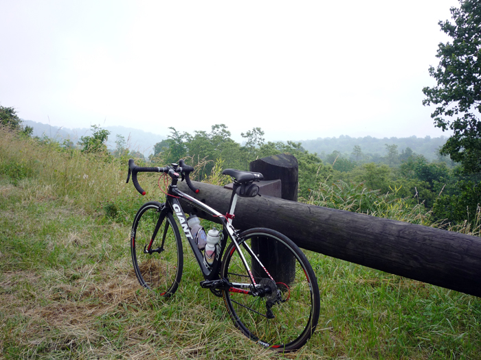
RAGBRAI: Day 4 Update
We are in Altoona, Iowa, near Des Moines, tonight. We did 100 miles yesterday between Carroll and Boone, which included an extra, optional 28 mile loop. The optional loop was nice because there were far fewer riders on it (which might be an indication of our lack of sanity). It was 97 degrees yesterday, so we rewarded ourselves with homemade ice cream in the shade from one of the vendors along the road.
Today's ride was only 57 miles, so we rode quickly, but lollygagged at lemonade stands,snow cone stands, and in towns. The road was flat and it was very sightly cooler than yesterday, so we had a good ride.
I am writing this on my phone, so I will post a longer entry later.
Today's ride was only 57 miles, so we rode quickly, but lollygagged at lemonade stands,snow cone stands, and in towns. The road was flat and it was very sightly cooler than yesterday, so we had a good ride.
I am writing this on my phone, so I will post a longer entry later.
Monday, July 25, 2011
RAGBRAI: A Quick Update After Day 2
We have had little or no cell phone service or internet access for the last couple of days and I am on a shared computer right now, so this will be a quick update. We have finished Day 2 of RAGBRAI, so we have covered about 130 miles so far. The route yesterday and today wound through southwestern Iowa, from Glenwood to Atlantic last night and on to Carroll, Iowa tonight. Both days have been pretty hilly, with over 4,000 feet of climb each day. Fortunately, all of the training we did for the Savage Century paid off. We finished each day feeling like the climbing wasn't too bad. It was not a sentiment shared by our fellow riders.
This is, by far, the most crowded cycling event I've ever done. Ten thousand riders do RAGBRAI each year, so there is never a point where you are alone on the road, in town, or in the campgrounds. In the mornings, the road is particularly crowded, but it thins out as the day goes on and people take breaks. Every town we pass through has a festival, including great food. Every organization in the pass through and overnight towns is out there selling great food to raise money. All of the churches sponsor lunches and dinners. We have sampled a wide variety of pie, cinammon rolls, pork chops, and lemonade, among other things. Today, I had a huge pork chop straight off the grill and gooseberry pie for lunch. We are eating our way across Iowa.
I will try to update more later and add pictures when I have better internet access.
Tuesday, July 19, 2011
RAGBRAI: 4 days and Counting
We leave for Iowa tomorrow and I will try to make updates from the road and the ride.
Sunday, July 10, 2011
The Catoctin Trail - Maryland's Other Long(ish) Trail
We made a quick trip up to Thurmont to hike with a friend yesterday. We decided to do a relatively short out-and-back on the Catoctin Trail, from its northern terminus at Mt. Zion Road to Cunningham Falls and back. The Catoctin Trail is a 26.5 mile long trail near Frederick, MD. It starts in Gambrill State Park, crosses the Frederick Watershed, Cunningham Falls State Park, and ends at the northwestern boundary of Catoctin Mountain Park.
The parking area is at the top of a ridge on Mt. Zion Road near the boundary of Catoctin Mountain Park. From there, it is one-tenth of a mile on a horse trail to the Catoctin Trail. We got a late start, so before getting too far underway, we stopped for lunch. The late start also meant we were hiking in the hottest part of the day. The trail trends downhills toward the Owens Creek Campground. It is marked sporadically with blue blazes. A couple of horse trails cross it so we had to check the map once or twice.
After crossing Owens Creek, the trail climbs steadily, but relatively gently, for a couple of miles. It was the kind of climb where you expect the top to be around the corner a number of times. I turned the corner several times only to find the trail still climbing. Still, it was a relatively easy, pretty climb through the forest. On the way down the other side, we crossed an area that had been hit by a tornado in 2004. The damage from the tornado is still visible in all of the large trees that are down. We found ripe wineberries below the rootball of one of the downed trees. Not many of those survived our visit.
We crossed MD Route 77 after waiting several minutes for a break in traffic and continued south to the trail down to Cunningham Falls. Up to this point, we had seen fewer than five people. As soon as we reached the trail to the falls, we found the crowds, not really surprising on a hot July day. The falls themselves were jam-packed with people. The amount of trash was a bit disappointing: I mean, how heavy is an empty water bottle to carry out? In spite of that, the falls were pretty. We took a break and then headed back up the trail to the Catoctin Trail. The return trip was uneventful, except for eating more wineberries. We hiked about 10 miles, total and I would hike there again, but perhaps visit the falls in the winter.
Pictures (click to enlarge):
 Cunningham Falls
 I tried out a neutral density filter for the first time yesterday. A neutral density filter allows a long exposure without overexposing bright parts of the image. It is pretty much made for smooth waterfalls on sunny days. I've had it for a while, I just keep forgetting it when we are going hiking in areas with waterfalls. The picture above is with no filter, with an exposure of 0.4 seconds.
 The same setup with the neutral density filter. What a difference. I did go in after I got home and lighten the shadows just a little bit.
 Impatiens capensis (Jewelweed, Touch-Me-Not)
 Prunella vulgaris (Selfheal)
 Geum canadense (White Avens)
 The view from the parking area on Mt. Zion Road.
The parking area is at the top of a ridge on Mt. Zion Road near the boundary of Catoctin Mountain Park. From there, it is one-tenth of a mile on a horse trail to the Catoctin Trail. We got a late start, so before getting too far underway, we stopped for lunch. The late start also meant we were hiking in the hottest part of the day. The trail trends downhills toward the Owens Creek Campground. It is marked sporadically with blue blazes. A couple of horse trails cross it so we had to check the map once or twice.
After crossing Owens Creek, the trail climbs steadily, but relatively gently, for a couple of miles. It was the kind of climb where you expect the top to be around the corner a number of times. I turned the corner several times only to find the trail still climbing. Still, it was a relatively easy, pretty climb through the forest. On the way down the other side, we crossed an area that had been hit by a tornado in 2004. The damage from the tornado is still visible in all of the large trees that are down. We found ripe wineberries below the rootball of one of the downed trees. Not many of those survived our visit.
We crossed MD Route 77 after waiting several minutes for a break in traffic and continued south to the trail down to Cunningham Falls. Up to this point, we had seen fewer than five people. As soon as we reached the trail to the falls, we found the crowds, not really surprising on a hot July day. The falls themselves were jam-packed with people. The amount of trash was a bit disappointing: I mean, how heavy is an empty water bottle to carry out? In spite of that, the falls were pretty. We took a break and then headed back up the trail to the Catoctin Trail. The return trip was uneventful, except for eating more wineberries. We hiked about 10 miles, total and I would hike there again, but perhaps visit the falls in the winter.
Pictures (click to enlarge):


Monday, July 4, 2011
A Wild Berry Weekend: Nicholson Hollow and Old Rag (ORMS)
A rare three-day weekend inspired us to get out of the city. We were scheduled for Old Rag on Sunday, so we decided to do some hiking on Saturday, camp, and then meet the rest of the Old Rag Mountain Stewards on Sunday morning. We arrived at the Old Rag parking lot at 11 a.m. to find it mostly full and a bit crazy, so we got our things together, filled out our permit and headed up the road to the Nicholson Hollow Trail.
Nicholson Hollow Trail is literally right next to Old Rag. We pass the traihead every time we hike Old Rag, but for some reason, we had never hiked it. The trailhead itself is about halfway between the Old Rag parking lot and the old Upper Parking lot. The trail starts on private land, crossing Brokenback Run and the Hughes River. After half a mile, we crossed into the park and started looking for a campsite. The plan was to find a campsite relatively close to the road so we would have a quick, easy hike to the parking lot in the morning. At the junction of the Nicholson Hollow Trail and the Corbin Mountain Trail, we found one that fit the bill: shady, flat, near the water. It even had a small waterfall nearby.
We ate lunch and set up camp before continuing up the Nicholson Hollow Trail. The trail follows the Hughes River slowly uphill. We passed Hot Short Mountain and Hannah Run Trails, also ones we have yet to do. We passed a few trail runners, but few other people. Evidence of the pre-park establishment settlements was everywhere: stone walls, a hearth, house foundations, and piles of rocks. After a couple of miles, we came to Corbin Cabin, which was restored and is maintained by the Potomac Appalachian Trail Club. We took a short break before continuing on the Indian Run Trail. The trail dwindled to a rocky path and climbed steeply over the next mile to the saddle between Stony Man and Thorofare Mountain. Each time we thought we might be at the top of the saddle, we would turn a corner to find it climbing even more steeply in front of us. It wasn't the most difficult climb I've ever done, but it was a good workout.
At the junction with the Corbin Mountain Trail, we turned right towards the Old Rag Fire Road. The trail appeared to get even less use than the Indian Run Trail. In places, the trail is just a grassy path through the trees. After a few minutes, we found an old spring right next to the trail. The ice cold water felt fantastic splashed on my face and hair. At the Old Rag Fire Road, we turned downhill for a half a mile to the Corbin Hollow Trail. We pass the bottom of the Corbin Hollow Trail every time we hike Old Rag, but it is another one that we've never set foot on. From the Old Rag Fire Road, the trail descends steeply to Brokenback Run and then follows it, through quiet, beautiful woods to the Weakley Hollow Fire Road.
We had not seen anyone since we left Corbin Cabin, on the Nicholson Hollow Trail. The moment we stepped out onto the Weakley Hollow Fire Road, we see a family, coming down from Old Rag who was out of water. They had a few small, empty water bottles on a 90 degree day and the kids were complaining of being thirsty. We gave them chlorine tablets so they could get water out of the stream and continued on our way. We arrived back in camp at dinnertime. We had wineberries that we had picked along the way for dessert (we had plenty of them while we were hiking, too. And black raspberries. And blueberries). While we drank tea, a Great Blue Heron flew low over our campsite. As the sun went down, fireflies lit up the forest and whippoorwills called across the valley.
We awoke around 4 a.m. on Sunday morning to a raging thunderstorm working its way down the valley. At one point, I was laying awake, counting the seconds between flashes of lightning and thunderclaps, there was no delay, meaning the storm was right on top of us. In the morning, after breakfast (with wineberries in our oatmeal!), we packed up and returned to the Old Rag parking lot. While we were waiting for other stewards to arrive, we were able to dry out tent out by draping it over the car.
The day promised to be a quiet one, based on the number of cars in the parking lot. We hiked up the Ridge Trail with another Steward. The ripe blueberries along the way were a mild impediment to our hiking. We had to take a wide sample of blueberries from many bushes to properly assess the quality of this year's crop. It was hot. The lower part of the Ridge Trail is back in the corner of the valley, so most of the time, very little wind reaches it. On hot days, it can be pretty stifling. We splashed water on our faces and heads at the spring that crosses the trail about halfway up. Once in the rock scramble, we tried to stay in the shade as much as possible. At the summit, we found a spot under the trees to take a break in the breeze. After some training on anchors at Byrd's Nest Shelter, we made our way down the Saddle Trail to the parking lot in the early evening. It was a perfect, quiet day on the mountain.
Pictures (click to enlarge):
 The Hughes River at our campsite.
 Our campsite
 The Hughes River.
 Chimaphila maculata (Wintergreen) on the Nicholson Hollow Trail
 An old hearth from pre-park days.
 Actaea podocarpa (Black Cohosh or Black Snakeroot)
 Impatiens pallida (Pale Jewelweed)
 The Corbin Mountain Trail above Indian Run Trail.
 Lysimchia quadrifolia (Whorled Loosestrife) on the Old Rag Fire Road.
 Asclepias exaltata (Poke Milkweed) on the Old Rag Fire Road.
 Sisyrinchium atlanticum (Eastern Blue-Eyed Grass) on the Old Rag Fire Road.
 Monarda clinopodia (Basil Balm) on the Corbin Hollow Trail.
 Wineberries for dessert and breakfast.
 The S-curve on Old Rag.
 An interesting beetle on the summit of Old Rag.
 Looking south from Old Rag towards Fork Mountain.
Nicholson Hollow Trail is literally right next to Old Rag. We pass the traihead every time we hike Old Rag, but for some reason, we had never hiked it. The trailhead itself is about halfway between the Old Rag parking lot and the old Upper Parking lot. The trail starts on private land, crossing Brokenback Run and the Hughes River. After half a mile, we crossed into the park and started looking for a campsite. The plan was to find a campsite relatively close to the road so we would have a quick, easy hike to the parking lot in the morning. At the junction of the Nicholson Hollow Trail and the Corbin Mountain Trail, we found one that fit the bill: shady, flat, near the water. It even had a small waterfall nearby.
We ate lunch and set up camp before continuing up the Nicholson Hollow Trail. The trail follows the Hughes River slowly uphill. We passed Hot Short Mountain and Hannah Run Trails, also ones we have yet to do. We passed a few trail runners, but few other people. Evidence of the pre-park establishment settlements was everywhere: stone walls, a hearth, house foundations, and piles of rocks. After a couple of miles, we came to Corbin Cabin, which was restored and is maintained by the Potomac Appalachian Trail Club. We took a short break before continuing on the Indian Run Trail. The trail dwindled to a rocky path and climbed steeply over the next mile to the saddle between Stony Man and Thorofare Mountain. Each time we thought we might be at the top of the saddle, we would turn a corner to find it climbing even more steeply in front of us. It wasn't the most difficult climb I've ever done, but it was a good workout.
At the junction with the Corbin Mountain Trail, we turned right towards the Old Rag Fire Road. The trail appeared to get even less use than the Indian Run Trail. In places, the trail is just a grassy path through the trees. After a few minutes, we found an old spring right next to the trail. The ice cold water felt fantastic splashed on my face and hair. At the Old Rag Fire Road, we turned downhill for a half a mile to the Corbin Hollow Trail. We pass the bottom of the Corbin Hollow Trail every time we hike Old Rag, but it is another one that we've never set foot on. From the Old Rag Fire Road, the trail descends steeply to Brokenback Run and then follows it, through quiet, beautiful woods to the Weakley Hollow Fire Road.
We had not seen anyone since we left Corbin Cabin, on the Nicholson Hollow Trail. The moment we stepped out onto the Weakley Hollow Fire Road, we see a family, coming down from Old Rag who was out of water. They had a few small, empty water bottles on a 90 degree day and the kids were complaining of being thirsty. We gave them chlorine tablets so they could get water out of the stream and continued on our way. We arrived back in camp at dinnertime. We had wineberries that we had picked along the way for dessert (we had plenty of them while we were hiking, too. And black raspberries. And blueberries). While we drank tea, a Great Blue Heron flew low over our campsite. As the sun went down, fireflies lit up the forest and whippoorwills called across the valley.
We awoke around 4 a.m. on Sunday morning to a raging thunderstorm working its way down the valley. At one point, I was laying awake, counting the seconds between flashes of lightning and thunderclaps, there was no delay, meaning the storm was right on top of us. In the morning, after breakfast (with wineberries in our oatmeal!), we packed up and returned to the Old Rag parking lot. While we were waiting for other stewards to arrive, we were able to dry out tent out by draping it over the car.
The day promised to be a quiet one, based on the number of cars in the parking lot. We hiked up the Ridge Trail with another Steward. The ripe blueberries along the way were a mild impediment to our hiking. We had to take a wide sample of blueberries from many bushes to properly assess the quality of this year's crop. It was hot. The lower part of the Ridge Trail is back in the corner of the valley, so most of the time, very little wind reaches it. On hot days, it can be pretty stifling. We splashed water on our faces and heads at the spring that crosses the trail about halfway up. Once in the rock scramble, we tried to stay in the shade as much as possible. At the summit, we found a spot under the trees to take a break in the breeze. After some training on anchors at Byrd's Nest Shelter, we made our way down the Saddle Trail to the parking lot in the early evening. It was a perfect, quiet day on the mountain.
Pictures (click to enlarge):


Subscribe to:
Posts (Atom)