Tuesday, November 28, 2017

Seventh Annual Hike Off the Pie: Camp Ridge, Shenandoah National Park

Last year, for Hike off the Pie, we had intended to bushwhack up to a mountain called Pinnacle Peak, descend the west side of it and then hike up to Skyline Drive and descend back down to the car via Camp Ridge and the Nicholson Hollow Trail. It didn't quite work out that way, so this year, we decided to do the Camp Ridge portion of that hike. Also, different than last year: this year's Hike Off the Pie was held on Saturday, which meant that Michael got to come along!

We arrived in the Old Rag parking lot at 9 a.m. and it was already nearly full. There were people everywhere, including a group of what must have been 30 people. We packed up, showed the rangers our park pass and made our way to the Nicholson Hollow trailhead. As soon as we turned off of the road, we left all of the crowds behind. We saw a couple of fishermen and one family in the first mile and they were the last people we saw until we were within a quarter mile of Skyline Drive. The hike up went smoothly. We had lunch near some ruins at the junction of the Nicholson Hollow Trail and the Corbin Cutoff trail. We took the latter up Skyline Drive and the walked on the drive for about a third of a mile to the spot where the Camp Ridge Trail once intersected Skyline Drive.

We think we found a few blazes, which got us started the right direction, or at least it was a happy coincidence. There was initially a footpath, but quickly lost it in a thicket of mountain laurel, so we generally made our way out to Camp Ridge using the map. As we were making our way along, Michael spotted the path again and this time, we were able to follow it all the way out to the end of the ridge. It wasn't an easy walk: the mountain laurel put up a good fight. I don't know when the Camp Ridge Trail was last maintained, but it is pretty grown over now. We had a snack at the summit of the little ridge. Then we started down the south side of the ridge, slowly making our way down the steep slope to the Hughes River. For the record, bushwhacking down a steep hill is much worse than going up it. We got very lucky and met the Hughes river at a spot without steep banks, so we didn't have to bushwhack downstream to cross. At that spot, the Nicholson Hollow Trail was right next to the river as well, so we didn't have to slog uphill to find it. On our way down, we were plotting our next bushwhacking adventure on a nearby ridge.

We made it to the road just as the last light faded and back to the car just after dark. It was a great day and the weather was amazing for November.

The ruin of an old cabin on Corbin Cutoff trail. Logs have been removed and this is mostly the second story.
 The wall of the cabin.
 A butterfly on a log. Like I said, it was incredible weather. Even at 2500 feet, it was probably close to 60 degrees.
 An old stone wall on the Corbin Cutoff Trail. If you look closely, you can see a tree growing on top of it near the center of the picture.
 Old Rag from Skyline Drive
 Michael on the old Camp Ridge Trail. This was some of the less dense mountain laurel that we had to push through. I have a love-hate relationship with mountain laurel. In May and June, when it blooms, it is beautiful. The rest of the year, I feel as though it is trying to kill me.
 Oak leaves.
 Fungus growing on a tree.
 The old trail through the mountain laurel
 Puttyroot orchid leaves. These little guys are interesting. They bloom in the summer, but they only put up leaves in the winter, when there isn't any tree canopy to block the light.
 I grabbed this branch for blance when we were descending off of the ridge. It turned out to be covered with tiny prickly things. I have no idea what the branch is or if the prickly spikes are thorns or some kind of parasite.
The final descent to the Hughes River. 

Friday, November 10, 2017

Odds and Ends: Old Rag, A Perfect Day, and the National Arboretum

I'm catching up on the last few weeks:

We volunteered on Old Rag two weeks ago on a lovely (weather-wise) Saturday. It was absolute madness. We arrived at 9 a.m. and the parking lot was already full. There was a line of 12 or so cars waiting to turn into the parking lot. The neighbor was already charging people to park in her pasture and she had opened up a second pasture so even more people could give her cash hike Old Rag.  We spent an hour in the lot talking to people about the hike and handing out flyers to recruit for Old Rag Mountain Stewards. When we turned on the radios at 10 a.m., we found an incident had just started. We headed up the mountain, pushing past lines of people and spent the morning assisting a hiker who had taken an unfortunate fall. It was about as smooth of an evacuation as we could have asked for and we spent most of the rest of the day on the summit, talking to people as they passed through. In my haste in the morning, I forgot my camera, so all of these are taken with Michael's camera, which is a point and shoot.
The helicopter approaching.
 I already talked about the crowding. That was before we had to close the trail for almost an hour while we worked to evacuate the patient. If you click to enlarge, you'll see the crowd backed up just after we re-opened the trail.
 The spot near the summit where I always take a picture.
 Changing leaves in the valley.
 Looking south from the summit.

The following week, we were contacted by NPS staff about helicopter hoist training on that Friday. Did we want to attend? Of course! It wound up being an amazing day.

To make it to Big Meadows in Shenandoah National Park by the training start time, we left the house at 5:15 in the morning and picked up another volunteer at the metro at 5:45 a.m. There was much grumbling all around, but then we got to see this nice sunrise:
 Looking east from Skyline Drive
 Old Rag on the right from Pinnacles Overlook on Skyline Drive
 Everyone taking pictures!
When we were almost to Big Meadows, we saw a mother bear and two cubs hunting for food near the road. This cub was nice enough to pose for us.
All three of the bears. The bears and the sunrise made us forget our unhappiness at having gotten up so early.

Then there was the training:
We spent most of the morning practicing attaching a litter to the hoist on the helicopter. Everyone had to wear fire-resistant clothing for the training.
Then, we got the chance to be hoisted up onto the helicopter while it was in the air, which was amazing. I am the person on the left in this picture. It wasn't actually all that high, but it was still pretty darn cool. Many thanks to the US Park Police and Shenandoah National Park staff for including us in the training.

Last weekend, the weather was kind of gross, so we went down to the National Arboretum.
 The bonsai exhibit is always fun to walk through. This time, there was a special exhibit of deciduous bonsai trees in the process of changing colors for fall.
 The old Capitol columns.
 The path in the native plants area.
Blue Bottle Gentian (Gentian andrewsii) - the last of the season's flowers.

Tuesday, October 10, 2017

Old Rag: Crowds and Ravens

We spent Saturday on Old Rag volunteering with Old Rag Mountain Stewards. It was a beautiful fall Saturday in October, which meant the parking lot was already full when we arrived to start our day. We got to spend a good part of our day with one of the park rangers, which was a rare treat. Fall is in full swing: the leaves are changing and the forest is shutting down for the coming winter.
 Goldenrod (Solidago sp.) blooming along the Saddle Trail
 A Woolly Worm caterpillar.
This is pretty representative of the crowds all over the summit most of the afternoon. There were so.many.people.

Around 4:30, Michael and I were talking about wrapping up for the day. The crowds were starting to thin and we were thinking of dinner. At that moment, a group came over and asked if we could help a member of their party who had an abrasion on their head. We patched the person up (it wasn't serious) and chatted with them for a bit. In the meantime, a thin layer of clouds had rolled in and we realized that we were nearly the last people on the summit of the mountain. It was quiet, the light was stunningly beautiful, and ravens soared and played on the wind. We stayed for another half an hour or so, just enjoying it. Old Rag can be magical under the right conditions and this was one of those times.
 Ravens taking a break on some rocks.
 The sun streaming through the clouds to the west of the mountain.
 A raven landing on a rock
 Soaring over the valley.
 This raven had picked up a bit of food left by a hiker on the summit.
 Looking west.
 Looking northwest towards Hot Short Mountain
 Looking south.
Leaves turning on the Saddle Trail on the way down.

Thursday, September 21, 2017

Oregon and Washington, Part Two: North Cascades National Park

Long, picture-heavy post warning:

In Part One, I talked about packing our backpacking gear and that we'd figure it out once we had arrived in Oregon. We kicked around both Olympic National Park and North Cascades National Park. Olympic NP would be closer, but we had been there in 2008. North Cascades NP was also north of most of the fires and smoke, so, in spite of the longer drive, it won out. It is a park I had wanted to visit for some time, too.

Now, North Cascades NP isn't on the way to anywhere and the town on the west side of the park, Marblemount, feels like an outpost at the end of the world. The "Next Services 74 miles" sign adds to that feeling. We did find a hotel room and the next morning, we arrived at the North Cascades NP wilderness information office with no plan in hopes of getting a permit. Starting on Sunday helps those odds quite a bit. So does being completely flexible. One of the rangers helped us set up a five day itinerary, issued our permit and we were on our way.

This was our first look at the mountains we were going to hike in. We started at Cascade Pass Trailhead, which is an hour's drive on a gravel road past the end of the world. Actually, the road is in pretty good shape and we managed to snag one of the last parking places in the lot.

The trail heads up from the parking lot in a long series of switchbacks. We stopped about 3/4 of a mile in to have lunch and Michael remembered that his camera was still in the car. He went down to get it and I sat on a log, chatting with a few hikers as they passed.
It was pretty quiet for a bit when this guy came around the corner (click to enlarge). He was actually much closer at first and probably in the neighborhood of 400 lbs. We surprised each other and I yelled at him to go on. He looked at me with all of the disdain of a local being inconvenienced by a tourist and meandered on his way. At that moment, Michael reappeared just in time to see him walk off. This was the first of four bears that we saw on our way up the pass. The rest of them were way to far away to get good pictures.
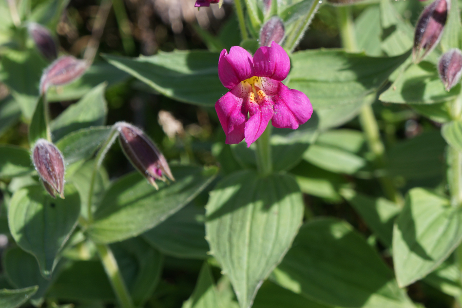
We also met this marmot near the top of the pass. We were whistled at by marmots at several points during our trip.
The trail near the top of the pass.
At the top of the pass, we got a view of the next valley. We would hike down this valley through the notch near the center left of the photo and down the next valley. There were a lot of dayhikers that just go up to the pass and then back to their cars. It is only a 7.5 mile round trip. Once we left the top of the pass, we left nearly everyone behind. After that notch, we only saw one person in the next two days.
Blueberries. These seriously interfered with our hiking speed.
 A waterfall on the outlet stream from Doubtful lake.
 The evening view from Basin Creek next to our first night's campsite.
Fall is well underway by the second week of September in North Cascades.
 The second day we hiked in the trees for several hours in the morning. This was kind of our first view of the mountains ahead of us.
 We hiked through a small burn from a 2015 fire. It was a bit like hiking through a graveyard.
 Heracleum lanatum (Cow Parsnip) along the Park Creek Trail.
 The sign for night two's campsite.
 Michael eating breakfast on day three.
 Hiking up Park Creek Pass. This is one of the most spectacular trail's I've ever done, which says a lot.
 Looking back down the pass (and straight into the sun) at where we'd come from.
 Mimulus lewisii (Pink Monkeyflower). It is so late in the season that most of the flowers we saw were at the tops of the passes.
 Looking north over Park Creek Pass. This was, hands down, my favorite part of a great trip.
 We descended pretty quickly off the pass (which is just to the right of the center of the photo). At this point, we discovered an error on the National Geographic map. It said it was 5.5 miles from the top of the pass to our campsite. After a few hours of hiking over relatively easy terrain, I started to wonder. When we got into our campsite, I checked the fitness app on my phone and it said 11 miles, not 8. I don't expect those to be super accurate, but they generally aren't off by that much and 11 miles was more consistent with the time it took us to hike that day. The bad thing about that was we had planed a relatively long hike the following day: 13 miles. The extra mileage meant it was going to be a 16 mile day.
 We got up before the sun on day four, so I didn't get great pictures of the old mining equipment near Skagit Queen campsite. This was the best one.
 We were retracing our steps, making our way back to Cascade Pass, which meant we had to hike up to Park Creek Pass again. As we were hiking, fog started rolling in.
 Campanula rotundifolia (Common Harebell).
 By the time we made the pass, this is what it looked like. It was completely socked in, raining lightly, windy, and cold. We were fortunate that the wind was at our backs, which made it less unpleasant.
Half an hour later, on the other side of the pass, it was a different day. Beautiful blue sky. Cool, but not cold.
 Dicentra formosa (Bleeding Heart)
 On day five, we got up early again. On the trail near the campsite, we saw this black bear track (headed away from where we were going).
 The Stehekin River at Flat River Campsite.
 Hiking back up towards Cascade Pass.
 The home stretch: Cascade Pass.
One of the switchbacks on the way back down to the car.
On our last day in the area, we did a little bit of front country sight-seeing. This is Diablo Lake. There are a few scenic overlooks along State Highway 20 and there's a couple of small visitor centers: one for the National Park and one for Seattle City Light, which operates the dams in the area.

North Cascades National Park is a pretty spectacular place. We only saw a little bit of it and I would definitely like to go back. The thing that I think is really cool about it is that you have to walk to see the most spectacular parts. There are some cool things to see from the road there, but to really see the place, you have to leave the pavement. On top of that, once we beyond dayhiker range, we saw very few people. It really is a special place.
After leaving Marbelmount and starting our drive back to Portland, we realized that we were going to hit rush hour on a Friday afternoon in Seattle. I did some quick searching and found Deception Pass State Park, which was only about 20 minutes out of our way. We spent a couple of hours on the beach and ate seafood for dinner instead of staring at taillights on I-5.