Sunday, September 29, 2013

Alpine Loop Gran Fondo

Since we didn't get enough cycling in this month in Oregon, we did another event today: the Jeremiah Bishop Alpine Loop Gran Fondo. Truth be told, we signed up for today's event before the Oregon trip was planned. We did the 78 mile route, which had 7,148 feet of climbing - twice the elevation gain of any day on the Oregon ride. I had a really good ride. The hills were good and challenging, but not impossible. The reward for the first ascent was a descent on a wide, newly paved sinuous road that descended at 9% for miles. There's nothing like hitting 40 miles per hour on a hill like that. I probably could have gone faster, but not knowing the road kept me on the brakes a little more than if it had been a place I was familiar with.

The second big descent was character building. There's also nothing like climbing as hard as you can and realizing that you could probably walk up the hill faster (but not in your road cycling shoes). On the other hand, the road wound its way up through a beautiful forest and the leaves are just starting to change. Not a bad place to work hard.

I only took a few pictures on this ride:
 The summit sign at the top of the first climb. It really is at that angle.
 The first touch of fall colors on the second climb which took us up to Reddish Knob.
Michael climbing higher up on the way to Reddish Knob.

Friday, September 20, 2013

Oregon Chapter 5: Final Day

Our last day in Oregon started out pretty chilly, at least compared to most of the other mornings on the ride. I suffered a bit for the first few miles since I knew it would warm up significantly. It is a bit difficult to dress for a day where the temperature will change 50 degrees over the course of a few hours. Layers are usually the answer, but on the bike, there's nowhere to shed them when it gets warm. My solution was to ride hard for the first leg of the ride on day seven.
Day seven promised another long climb up a mountain pass. With six days of riding behind me, I actually felt pretty good. At the top, we were rewarded with this view and a long, winding descent. The only thing that made the descent less than perfect: cattle guards, nine of them. A small price to pay for such a beautiful ride.

Near the bottom of the hill, we had a rest break with a great view. This is looking back on the mountain in the picture above.
The last ten miles of the ride took us on U.S. Highway 26, where we had the most traffic of anywhere on the ride. The traffic wasn't anything compared to what we are used to in Maryland, but it was still a lot after being able to ride for hours on rural roads without seeing another car. The three of us were cruising along in a small paceline, just focused on getting to town (and not having to sit on a bike seat anymore), when Michael got another flat. On the bright side, I got to take some great pictures that we never have stopped for otherwise, since all we were worried about was finishing. The Strawberry Mountains are above.
Looking east towards John Day, Oregon and the finish line.
We finished!
Final mileage for the ride.

When planning the end of the trip, I just took the directions from the Cycle Oregon materials for the most direct route back to Portland. We had a flight relatively early in the morning and I figured we'd just get their as quickly as possible. The route wound up being one of the biggest surprises of the trip, just because the amazing views and scenery were so unexpected. It was an area of Oregon I had never seen and I knew nothing about the roads before we were on our way back to Portland.
It started as soon as we turned off of U.S. Highway 26, just 38 miles west of John Day. This is Picture Gorge from a pullout near the John Day Fossil Beds National Monument visitor center (which was, unfortunately, closed for the day). We got a bit of a late start out of John Day, but that wound up being a great thing because the light on the hills was incredible.
Another view of the hills in John Day Fossil Beds near the visitor center.
An irrigated hay field in front of the hills.
We were driving northwest, so it took a very long time for the sun to go down. We wound up chasing the sunset for a couple of hours - probably the longest sunset I've ever seen. West of Condon, Oregon, we came out on a high plateau with a number of wind turbines. While we were stopped, the awesome mechanics from the Bike Gallery in Portland passed us, one of only about half a dozen cars that we saw in several hours of driving.
About fifteen minutes after we stopped for the wind turbines, from the backseat, our friend said, "STOP THE CAR!" This view of Mount Hood was the reward for the slow drive and late departure from John Day. A fitting end to two wonderful weeks in my favorite state. 

Thursday, September 19, 2013

Oregon Chapter 4: Cycle Oregon Days 4-6

Day four of Cycle Oregon was a layover day in Diamond, Oregon (population 5).
Even though no one technically had to be anywhere, people were still up and about in camp really early, so I caught the sunrise. There were a bunch of activities that riders could do, there was an optional ride, or one could just hang out in camp. The only trouble with the campsite in Diamond was that there was no shade and it was going to be hotter than the previous day. 

Since we didn't want to take the vans up to Steens Mountain, we figured we may as well ride. The route description originally gave the option of a 50 mile or an 80 mile ride, both out-and-backs. We were debating the merits of the longer ride at breakfast when another rider said that the route had been shortened. The announcement had been made while we were at the wine dinner the night before. Apparently, a rancher needed to drive 500 head of cattle across the road at mile 24, so the only choice was a 48 mile ride. Sometimes it is nice to have decisions made for you.
Heading out for the morning's ride.
The sign at the turnaround, just north of the cattle drive.
We weren't allowed to get very close to the cattle drive (for good reason), but I was able to catch a few of them.
After the ride, we went back over to the Hotel Diamond for some shade and wifi. Unfortunately, everyone else in camp had the same idea, so we shared the shade and overwhelmed the hotel's wifi. It was a good afternoon anyway. This is the view on the drive over.
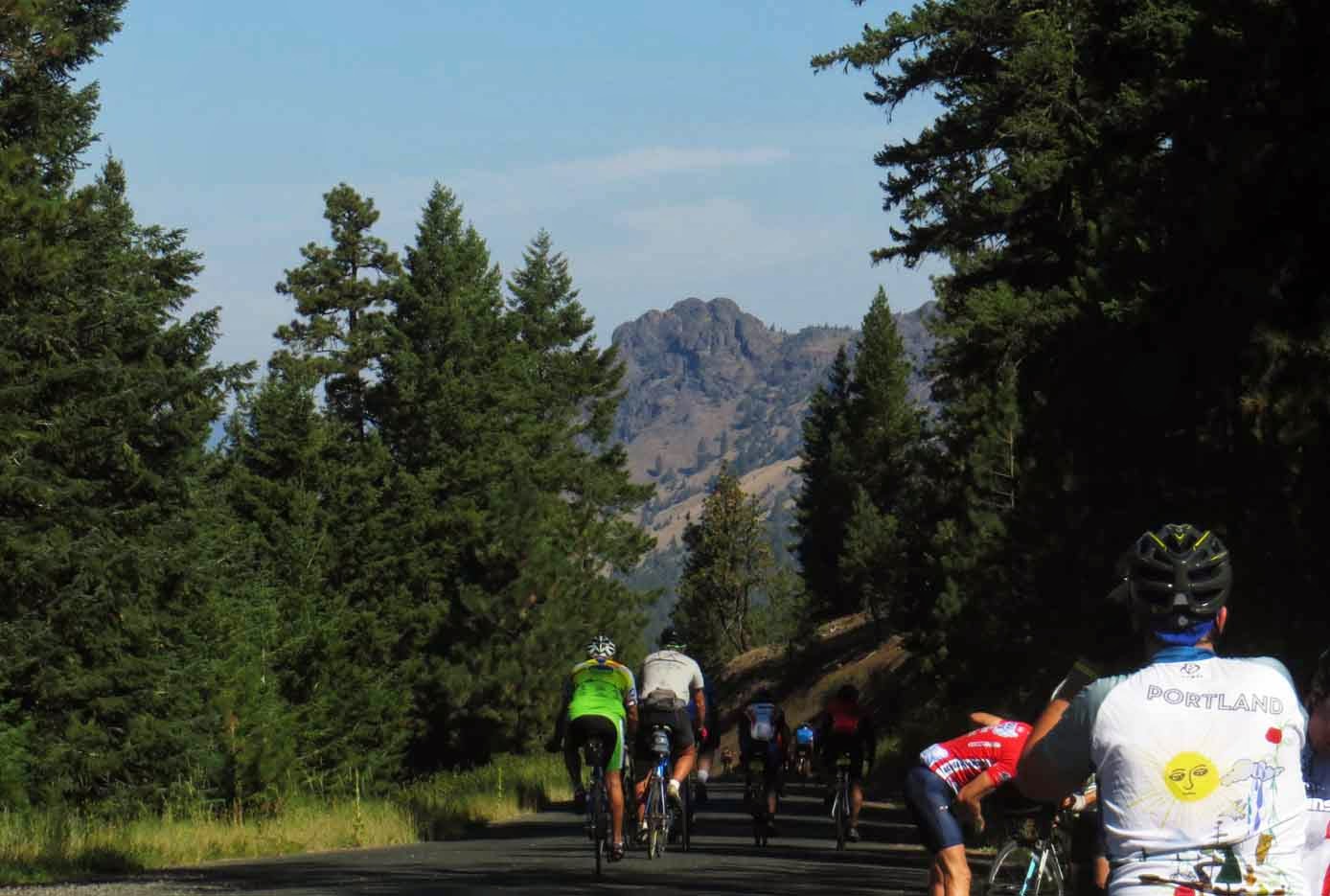
Back in camp, Portland-based Community Cycling Center was offering charging services at each overnight stop. Those are cell phones charging in plastic zipper bags, which the staff cheerfully referred to as IV bags.
The solar panels the Community Cycling Center used to power their charging station.
At the end of the day, we went to a star party put on by some of the astronomy clubs from Sisters and Portland. We got to see closeups of the moon and the rings and a moon of Saturn. We also saw the Chinese Space Station transit the sky. The area of Oregon we were in is one of the darkest places in the continental U.S. due its distance from major population centers. 
Day five dawned with a little bit of cloud cover, which was a relief after several days of riding through the high desert in the blazing sun. We had a nice, flat 40 mile ride to Crane, Oregon.
We made a stop at the Pete French Round Barn, which was used to train young horses and keep them in shape during the winter. They would then be ready for work in the spring.
Crane (population 51) was the overnight stop on day 5. Nearly half of the geographic space in town is occupied by the high school. It is likely the only public boarding high school in the U.S. The school district covers 7,500 square miles (for reference, that is more than half the size of Maryland), making it impractical for students on far flung ranches to be bused to school every day. Approximately 100 students stay in dormitories and go home on weekends.
We camped on the Crane High School football field. We noticed two things:  1) The kids still had practice that afternoon, but they had it on the lawn of the local Mormon church. 2) The field doesn't have lights, so they don't play any night games.
One of the amazing things about Cycle Oregon was the showers. Four tractor trailers that had been converted into shower rooms were parked near the campground. Each one of them had two shower rooms with about eight showers in them, complete with hot water. Each trailer also had a set of sinks on what was basically a drawer under the trailer. Getting a shower each night while camping was a really nice luxury.

On Day 6, we rode 73 miles from Crane to Seneca, Oregon. I was feeling really strong by this point, but it would actually turn out to be a very long day for Michael and me.
This was along U.S. Highway 20 east of Burns. It was the only real highway we had to ride up to this point, and it was only four miles. We are climbing towards the mountains and, again, grateful for cloud cover. In spite of the passing lane in the picture, the climbing wasn't too bad.
Just after we turned off of the highway, we got our first glimpse of the mountains to the north. We would have to ride through them later in the afternoon.
And then the flat drama started. Michael got four flats over the course of 12 miles, which added a couple of hours to our trip.
The sag wagon checks to see if Michael has what he needs to get back on the road. Fortunately, we didn't have to ride in the van.
We had one 1.5 mile stretch of gravel on day six, always an adventure on skinny road tires. We finally rode into camp at 4:30 (we started at 8 a.m.). Our friend, once we found him, had picked out a nice campsite and I got a massage that night. Earlier that afternoon, I realized I was having trouble shifting into the smaller cogs on my cassette. One of the mechanics from the Lake Oswego Bike Gallery store replaced my rear derailleur cable and re-adjusted my drivetrain. Not a bad last night on the ride.

Tomorrow, I'll post pictures from the final day of Cycle Oregon and the drive back to Portland.

Wednesday, September 18, 2013

Oregon, Chapter 3: Cycle Oregon Begins

After a week on the road in Oregon, we finally arrived in John Day ready to ride. 
As soon as we got out of the car, members of the John Day High School football team arrived on a four-wheeler to carry our bags to our campsite. 
We set up camp on a baseball field under the blazing sun, with the Strawberry Mountains in the distance. As soon as we were done, we went off to find some lunch (a smoothie) and build bikes.
Michael dragged the bike boxes off into the shade to work on them. This is my frame coming out of the box.
After building them, we took them for a spin on the local bike path to make sure everything was working correctly. This is one danger I don't face on the bike paths on my morning commute.
We got up early Sunday morning to begin the ride:  a 73 mile loop through the Strawberry Mountains with over 4,300 feet of climbing. This first hill was 35 miles long.
At the top of the first hill. This easterner could definitely feel the altitude as we climbed up to over 5,000 feet.
The view at our first lunch stop of the ride. The Strawberry Mountains are in the background. The loop brought us back to John Day, where we spent a second night.
On Monday, we began the journey south to Burns, Oregon:  71 miles with 3,200 feet of climbing over the course of two big passes. I felt good the second day and found a groove on the first long climb. It was a beautiful, winding road up a nice cool pass in the Strawberries.
Our lunch stop on day 2 was in the Silvies Valley south of the Strawberry Mountains. Out of the mountains, it was hot and it would remain that way the whole week. All three of us had a little trouble staying hydrated.
At the lunch stop, the Silvies Ranch had a number of animals on display, including these Clydesdales.
At the top of the last climb on Day 2 and closer to Burns than John Day.
This woman is using her llama to pack cyclists' bags to the luggage trucks.

We accidentally camped near the luggage trucks in Burns. For some reason, a whole bunch of people like to get on the road before the sun rises. We paid for that mistake by lying awake at 4:30 a.m., listening to people pack up their camp so they could have their bag on the truck the moment it was opened up. I'm all for getting up early to beat the heat (and it was hot), but that was a little insane. It wasn't as if we were sleeping in. We were on the road by 7:30 a.m. most days. We did not make that mistake again.
On Day 3, we had a mostly flat ride, 63 miles, from Burns to Diamond, Oregon. This is Malheur Lake south of Burns. This is the largest body of water we would see all week. It is part of the Malheur National Wildlife Refuge and is a major stopover for migratory birds. We saw flocks of Snow Geese in this area.
A hummingbird at the Malheur National Wildlife Refuge headquarters, where we had lunch.
Another view of the refuge and Malheur lake.
We only had two hills of significance on day 3 and they were nice and short. This is the second one and it was only 1.5 miles long. The entire day's ride was in the blazing sun.
 Our first view of Steens Mountain in the distance.
 Riders in the afternoon sun.
Our first view of our camp at Diamond.
Camp at Diamond with Steens Mountain in the background.
We decided to celebrate doing the ride with a wine dinner at the Hotel Diamond, located next to an old stagecoach stop. The food was amazing and it was a fabulous way to spend the evening. This is the cabin on the back of the hotel where we ate.