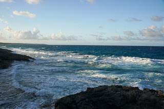
The Atlantic side of Long Island near the resort where we stayed.
Snorkeling! Yep, I'm wearing long sleeves. I really didn't want a terrible snorkeling sunburn.
A ray partially buried in the sand.
Coral and fish on the Caribbean side of the island.
The Caribbean side of the island.
The following week, we managed to get a dry hike in on Buck Hollow, Buck Ridge and Marys Rock in Shenandoah National Park. May was rainy, seriously, record-setting levels of wet. The day we hiked this, we just accepted that we were going to be in the clouds and wet the whole time. It actually didn't turn out that way. We could see the clouds just north of us, but it was sunny and a bit above 80 where we hiked. Ten miles north of us it was 60 degrees.
We climbed Buck Ridge first. This is the bottom of the staircase on that notorious climb. Although it has been several years, I hadn't actually hiked it since they put the steps in. It used to be a steep, gravel mess.
Rhododendron canescens (Hoary Azalea)
Cypripedium acaule (Pink Lady Slipper)
A little Box Turtle on the trail.
Michael at an overlook near Marys Rock.
Looking back towards Thornton Gap.
For Memorial Day, we decided to pick up a gap in the Appalachian Trail that we hadn't hiked: Rockfish Gap to Reeds Gap. A friend came with us. We started at Reeds Gap and hiked north. The forecast wasn't great, but we decided to go anyway. We got some sun, but it was pretty wet at times, too. There were lots of northbound AT thru-hikers on this section at the end of May.
The view from the Blue Ridge Parkway where the Appalachian Trail crosses it just north of Reeds Gap.
Polygonatum biflorum (Solomon's Seal)
Kalmia latifolia (Mountain Laurel)
It poured on us before we got to this overlook, but we got a break in time for a view.
Our first campsite. We got in and managed to pitch our tents just before a thunderstorm hit us. We spent the evening in a damp cloud. It cleared by morning, though.
Michael on some cliffs north of where we camped.
Rhododendron catawbiense (Catawba Rhododendron)
The view from Humpback Rocks. This place was pretty crowded.
The AT symbol on a log near where we ate lunch.
The creek near the Paul Wolfe Shelter. We camped near the shelter our second night.
Our last day was spent in the fog. This is the W.J. Mayo Homeplace right along the AT.
We hiked north to Rockfish Gap and then into the park to McCormick Gap, where we had left the car. It was nice to get out for a few days.


No comments:
Post a Comment