Monday, February 17, 2014

Old Rag: Deep Snow Edition

It snowed a lot here last Thursday. Even in the city, we had eight inches or so. I got a little snowshoeing in on Friday with some friends at Greenbelt Park, but with rumors of two feet out in the mountains, a little local snowshoeing wasn't going to suffice. We also had two boxes to check: 1) Michael had never snowshoed Old Rag; and 2) Until yesterday, Michael and I had hiked Old Rag every month of the year - except February. We realized that a few years ago, but there were always higher priority places to go (after all, we've been up there...oh...a lot). Two feet of snow changed the equation. We met four friends in the parking lot and promptly got our car stuck in a bit of deep snow. It really didn't look that deep and we parked next to a car with similar clearance (which might still be there). With a little push, we parked in a better spot and we were on our way up the road to the trailhead.

At the trailhead, more than a foot of crusty, heavy snow was on the ground. Enough people had hiked the Ridge Trail before us that there was a path, but it was too narrow for snowshoes. Where there was enough room, we broke a trail beside the path. As we climbed, the snow got softer and fluffier. We stopped at the first false summit for lunch before tackling the rock scramble. Just before the rock scramble, I stowed my snowshoes and put on microspikes since snowshoes aren't very maneuverable. When I snowshoed Old Rag three years ago, the first part of the scramble was the diciest: an inch of ice coating all of the rocks. This time, we were lucky as many of the crevices were filled with deep snow, the boulders were dry, and there was very little ice. The deep snow, while making the whole hike a lot more work (and more rewarding), actually made some of the areas on the rock scramble easier.

There were fewer tracks beyond that first drop. We did appreciate that someone else post-holed through drifts that came over my knees. There was easily two feet of snow on the ground and the drifts were a lot higher than that. By the time we reached another false summit, it had clouded over and we could see snow falling on mountains to the west and south. At the summit, snow fell steadily. Another first: That is the first time I've been on Old Rag when it was snowing. In spite of the weather, the ravens floated and played on the wind around the summit.

The descent down the Saddle Trail was fun. Soft, fluffy snow made for easy snowshoeing. The fire road, was another story. We were back to the beaten path that was too narrow for snowshoes and crusty snow that was exhausting to snowshoe on. We changed back to the microspikes and just walked down in the path. With better snow, we would definitely have enjoyed snowshoeing all the way down. We were also running out of daylight and we could walk in the path faster than we could punch through hard snow. We arrived back at the car at dusk. I couldn't have asked for a better day, be it crowds, weather, or conditions. We saw fewer than ten people on a mountain that can be completely overrun.

BTW, if you are headed up there in the next few weeks, traction devices are a must. As the snow that is up there now melts, it will get a lot icier.
 Old Rag from the road near Sharp Rock Vinyards. It started out as a perfect bluebird day.
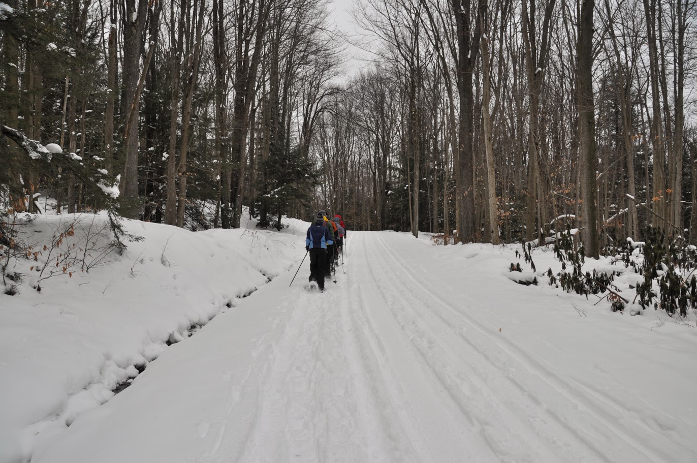
 Making our way up the Ridge Trail.
The view from the first false summit, looking south. Clouds had started moving in, but it was still bright that direction.
A few minutes later, the view of Robertson to the west from the beginning of the rock scramble. We could see bands of snow falling to the west and south at this point.
 Scrambling up through deep snow.
Although there was less ice than I've seen in the past, that doesn't mean we avoided it entirely. This spot seems to ice over for most of the winter.
Climbing up through the Chute, which is usually the most challenging move in the rock scramble. When not filled with snow, this move involves hauling oneself up and over a large rock and then up into a steep crevice that appears to have no handholds (it does, but you have to look for them). Snow was packed into it, so it was a slippery walk up instead.
 A cool drift along one of the narrow ridges.
 The spot where I usually take a picture. This is the most snow I've ever seen on it.
 Looking down Weakley Hollow from the summit. Snow fell steadily at this point.
The summit from the Saddle Trail. If you click to enlarge, ravens are visible in the air just to the left of the summit.

Monday, February 3, 2014

Great Falls: Avoiding the Crowds

Sunday was beautiful, especially for the beginning of February. Since Michael and I were invited to a party for a particular football game that night, we decided to a local hike. After some deliberation, we landed on Great Falls. To be honest, we've avoided the Billy Goat Trail at Great Falls in Maryland like the plague. Michael and I hiked Loop A once, several years ago. We went on a Saturday afternoon in October during fall colors. Talk about a trail that has all of the challenges and problems of Old Rag (complete with a rock scramble), but compounded by the fact that it is ten minutes from the Beltway and half as long of a hike. I think we were out there with most of the rest of the city. The crowds were so overwhelming that we didn't even make it to Olmstead Island, but some recent posts on hiking forums about hiking there made me want to try again.

We picked up a friend and headed out early Sunday morning. To beat the crowds, we hiked Olmstead Island first, then Loop A of the Billy Goat Trail (the most popular), followed by Loops B and C, a total of about 10.5 miles. When we arrived, the fee station hadn't even opened. We saw a handful of people on the boardwalk on Olmstead Island. We probably encountered fewer than a dozen people each on Loops A, B, and C. We returned to the car via the C&O Towpath, which was fairly crowded by mid-afternoon, when we were on our way back. Given the warm weather on Sunday, we managed to avoid the crowds pretty successfully.
Great Falls of the Potomac River from Olmstead Island. The weather on Sunday couldn't have been better. By mid-afternoon, it was almost 60 degrees.
A smaller waterfall on Olmstead Island.
 Ice crystals in a boot track on the Billy Goat Trail Loop A.
A frozen pool along the trail. These little pools are important to amphibians in the area.
The Potomac River from Loop A.
Shells on Purple Horse Beach.
Rocks worn by the strong currents of the Potomac on Purple Horse Beach. I did a search to find out why the beach is so named. Unfortunately, the first page of google hits were for drownings at the beach (the current in the river is deceptively strong, even where it looks placid. The Washington Post did an excellent story last year on why the river is so dangerous around Great Falls).
 Ice and some wicked standing waves on the river.
On Loop B, we saw a lot of evidence of beaver activity. The teeth marks on this tree are pretty impressive.
 They are even more impressive when looking at the whole tree trunk.
 A Great Blue Heron on the C&O Canal.
The canal was frozen over in most places.
On our way back, a Red Shouldered Hawk (Thank you, Katrina! if anyone knows the species, please let me know) swooped low over us and landed in a Sycamore Tree across the canal. In this picture, it is watching a squirrel below it.
By afternoon, the skies were overcast, giving the frozen canal a steel blue color.
An island in the canal.

Tuesday, January 28, 2014

Snowshoeing in West Virginia: Blackwater Falls and Dolly Sods

We spent the weekend at Blackwater Falls State Park in West Virginia with several friends from Old Rag Mountain Stewards. The state park has wonderful cabins that are practically a steal to rent, especially when divided by a crowd. We booked the cabin a while ago for a weekend of snowshoeing and good food. Two weeks ago, we were worried that there wouldn't be any snow at all, but we arrived at our cabin to find a foot of the lightest, fluffiest, driest powder that I've seen east of the Rockies.
Friday afternoon, we went down to Blackwater Falls was mostly frozen. The reddish color in the ice and in the water is tannins from the cedar forests surrounding the river.
Icicles near the falls. I really liked the patterns in the ice.

Friday evening, we headed over to the town of Thomas to the Purple Fiddle for dinner, a band, and some incredible people watching. The band was pretty good, if not my style of music, but the people watching was priceless.

We spent Saturday snowshoeing all over Blackwater Falls State Park. The high for the day was only around 20 degrees and the wind got progressively stronger as the day went on.
We followed the Canaan Loop Road to Lindy Point Overlook.
The Blackwater River canyon. The wind at the overlook was enough to take my breath away.
The curling bark of a paper birch tree.
 Michael breaking trail through fir trees.
The snow really picked up in the afternoon. It was cold enough that the trees popped and cracked as we hiked through the woods.
Balancing Rock in Blackwater Falls State Park. This isn't a great photo, but there isn't really a place to get a nice clear shot of the rock formation. Nonetheless, it was worth the hike to it.
At the end of the day, the group humored me by parking at the lodge so I could run down the Elkala Trail to see Elkala Falls. We ran into a couple we had seen near Balanced Rock earlier in the day. We chatted with them and mentioned that we were going to see the waterfall, to which they responded, "There isn't any waterfall." I pulled out my map, which showed that the falls were right by the bridge that we could see and that the couple had just walked over. They shrugged and continued on their way. We walked out onto the bridge, looked down, and there were the completely frozen falls. It took some work to get down to them and get the shot from below. Let's just say it was good to have traction devices.

Sunday, we headed for Dolly Sods, which is one of my favorite places to hike in the winter. We made the climb up the ski run in good time, getting a few funny looks from people who had the good sense to ride a lift to the top of the mountain. We started out in the sun, but by the time we reached the entrance to the wilderness, it was snowing again. It is a little strange to stand on the edge of the run, watching the crowds of skiers and snowboarders go by, then turn around and walk twenty yards into the wilderness area and a completely different world. 
The entrance to Dolly Sods Wilderness. No one else had been up there that morning, so we had untracked snow and complete solitude.
Michael making hot drinks for lunch.
Dolly Sods can have frightful weather. On Sunday, we experienced freezing cold (maybe twenty degrees), gale force winds, and lots of snow - some of it fell from the sky and some of it was just blowing around. It was hard to tell which was which sometimes. We plowed through drifts over our knees in places. When we finally turned around, we found a lot of our tracks and been completely covered by snow, even though we had only been there less than an hour before.
 Later in the afternoon, the sun did try to come out.
The trail through some cedars. We decided this would have been the perfect place to camp since it was sheltered from the wind.
 Looking west across the Canaan Valley. We got just a sliver of a sunset in the distance, beyond the clouds.
A friend of ours hiking along the ridge.
Breaking trail out in the open.
Blowing snow on the western edge of the ridge in Dolly Sods. I was just a little bit sad that we weren't camping out. It was such a beautiful day and there was so much snow that I wanted to spend more time out there. Unfortunately, we all had to get home for work on Monday. 

Sunday, January 19, 2014

Long Mountain: Bushwhacking in the Snow

Yesterday's hike started from the Trout Run trailhead along Trout Run Road in the Great North Mountain area of the George Washington National Forest. This area is just over the border into West Virginia, near Big Schloss. There was about an inch of snow on the ground at the trailhead. It was also cold, around 18 degrees. Our party included two dogs, who were very, very happy about the snow. One of them started his hike by doing barrel rolls in it. We crossed Trout Run on a nice footbridge and then began the climb up to the top of Cherry Ridge. The snow got a little deeper as we climbed, but not too bad. Every time the wind blew snow up my pant leg I repeated my wish that I had remembered my gaiters. 

We made good time getting up and over the ridge and soon enough, we reached the point where we needed to leave the trail and begin the nearly 2.5 mile bushwhack over Long Mountain. Since that spot was relatively sheltered from the wind and it was sunny, we took a standing break for lunch. Before long, though, everyone was cold and it was time to move on. 

The first 100 yards of the bushwhack were tough. The area had been cleared relatively recently, so it was pretty overgrown with small trees and shrubs. Once we pushed through that, the forest opened up and travel became a lot easier. We meandered our way up the ridge, aiming for a rock outcrop called Dog Rock. I suspect we meandered a bit too far southeast and I am not sure we made it to Dog Rock itself. The ridgeline of Long Mountain is dotted with outcrops. None of them, from what we could see, stand out as distinctive from the others. We had a nice view through the trees, though, given the wind, we didn't linger. We descended a steep gully, happy that it was free of snow and meandered generally east through the woods towards Trout Run Road. 

At the bottom of the valley, we followed an old road bed, which paralleled Trout Run Road. The idea was that we would be able to spot a gravel road on the other side of Trout Run Road (which we could see) through the trees. With the snow, we completely missed it and wound up at the boundary of some private land. At that point, we decided to walk back up the Trout Run Road so we wouldn't miss it again. It turned out that we had only missed it by a hundred yards or so. 

Back on trail, we made great time on the last half of the hike. Towards the end of the hike, we saw one other hiking party - the only other people we encountered the entire day. We arrived back at the car right at dusk. It was a cold, beautiful adventure.

Trout Run at the beginning of the hike.
Michael hiking up the Long Mountain Trail above Trout Run.
The junction of the Long Mountain Trail with a fire road.
A small stream on the east side of Long Mountain.
A clump of snow caught in the needles of a White Pine.
Hiking up the untracked Half Moon Trail.
Sunset near the end of the hike on the Bucktail Cutoff Trail.