Sunday, October 27, 2013

Old Rag: Turning Leaves, Ice, and a Rescue

At the last minute, Michael and I decided to go to Old Rag yesterday for a day with Old Rag Mountain Stewards. Another volunteer had put together a geology talk about the mountain and we thought it would be interesting to hear it. By the time we arrived, the large parking lot was full and the neighbor's pasture was about half full (to the tune of $10 per car).

Like last week, we hiked up the fire road first to avoid the crowds. The leaves don't seem to have reached peak colors yet - there is still a lot of green in the valleys, but they also don't seem like they are as bright this year as they were last year.
We stopped for lunch on a boulder along the Saddle Trail and found a leaf with two of these little guys. This is some type of caterpillar, but it is the first time I've ever seen one. so I am not sure what it is. As usual, if anyone has any ideas, send them my way. Thanks to Bob Look for identifying this as Isa textula (Crowned Slug Caterpillar), which turns into the Crowned Slug Moth.
The first hoar frost of the year, pushing up from a bed of moss on the upper Saddle Trail. Nearby, there is also a seep right on the trail that ices over around this time of year. What was damp last week was icy this week. Sunlight almost never hits it and the wind tends to blow there most of the time. Once it ices over, it will often be frozen until March or April.

Ice in one of the many potholes on the summit.
 Looking south from the summit of Old Rag.
The boulder scramble below the summit. I took a similar photo last week and the leaves don't appear to have gotten any brighter. Most of the trees higher up on the mountains are bare.
We were just about to head down the Ridge Trail and listen to a geology lesson, when we received a call for an injured hiker. We spent the rest of the afternoon and most of the evening working with the National Park Service and the Shenandoah Mountain Rescue Group to get the patient safely to transport. This is a shot of the summit right at dusk from the Saddle Trail. We had stopped to take a quick break at a spot I have hiked by a thousand times before without really looking up. As I was looking around, I realized I had a clear view of the summit and just enough time to get my camera out.

Monday, October 21, 2013

Old Rag: Back Open for Business

After seventeen days' respite during one of the busiest times of the year, Old Rag - and the rest of the National Park System - is back open for business. I expected that this past weekend, normally one of the busiest of the whole year, would be absolutely insane. I figured that everyone who had wanted to hike the mountain over the past two weekends would be out. I don't know what Saturday was like, other than hearing reports that it was pretty busy, but yesterday was surprisingly quiet, for Old Rag, at least. The parking lot certainly filled, but the crowd was pleasant and friendly.

A new volunteer joined us and we did our normal fall weekend routine: Walk up the fire road against the prevailing hiking direction. The fire road is beautiful this time of year, with bright yellow tulip poplars lining both sides of it. Hiking the opposite direction of most people allows us to avoid the long lines at various choke points in the rock scramble and it allows us to find out what is going on above us on the mountain by chatting with descending hikers. We lingered on the summit for quite a while and, once we decided the crowds had thinned, descended through the rock scramble. It was a nice fall day to be out on the mountain and it was a great day for another reason. Believe it or not, I haven't summitted Old Rag in almost a year due to a foot injury that stubbornly refused to heal through the spring. It is on the mend now and it is wonderful to be back in the woods.

Pictures:
A maple leaf near the summit.
Looking south from the summit towards Fork Mountain.
Hamamelis virginiana (Witch Hazel). This is the last flower of the year to bloom - a sure sign that winter will soon arrive.
Looking east from the summit and down the rock scramble.
Dennstaedtia punctilobula (Hay Scented Ferns) in a crevice in the rock scramble.
Fall colors at the spot where I always take a picture.
The view from the first false summit in the fading sunlight.

Monday, October 14, 2013

Ohiopyle State Park: Escaping the Rain

It rained a lot in the Mid-Atlantic last week. A Lot. Baltimore-Washington International Airport received over 5.5 inches of rain on Friday alone. By Sunday, we were ready to see some sun and dry out a little bit. With federally-managed lands closed due to the government shutdown, we figured it was a great time to visit a state park. We headed west with Wild Type of Horizontal Tread, away from the storm, to Ohiopyle State Park in western Pennsylvania. Ohiopyle State Park has been on the hiking to-do list for a long time, but it is a three-hour drive, so we just hadn't gotten around to it before. We did a series of relatively short hikes that added up to seven or eight miles and let us check out several of the park's many waterfalls, which is the longest distance I've hiked since January of this year.

We started with the Meadow Run area. We did a loop that took us to a series of low waterfalls. Ironically, the streams were all running low in Ohiopyle State Park. Although it had rained the day before, the park is too far west to have gotten much of the rain from last week's storm.
The Meadow Run Cascades.
Looking down Meadow Run at the first hints of fall colors.

After completing the loop, we drove to Jonathan Run trailhead. We hiked down the trail along the stream, meeting just a few other hikers on the way. The fall colors are really just getting started, but we were treated to some bright leaves.
A pretty yellow tree along the trail.
Looking down Jonathan Run.
A bright orange fungus on a downed log. Maybe Chicken of the Woods?
Upper Jonathan Run Falls.
Getting to the lower falls on Jonathan Run was a quite a scramble. Since there had been a little bit of rain the day before, slippery wet leaves and roots made it even more interesting. I think I made most of the descent on my rear end. The view was totally worth it.
Another view of the lower falls on Jonathan Run. After scrambling back up to the trail, we hiked a little further downstream to the Great Allegheny Passage Trail, which passes through the park. We took a short break before returning to the car the way we came.

Our next stop was supposed to be Cucumber Run, but the parking lot was completely full, so we decided to go see the main attraction:  Ohiopyle Falls on the Youghiogheny River.
The main falls from the Ferncliff Natural Area, across the river from the main viewing platform. The area was pretty crowded with sightseers and fishermen, but it was worth the walk to get below the falls.
These fossils were a neat surprise on the walk down to Ohiopyle Falls. This is a Lepidodendron (a type of tree known as a scale tree) fossil. We saw other fossils, but most of them weren't clear enough to photograph well.

After returning to the car, we made another, this time successful, attempt to see Cucumber Falls. It was worth the wait.
 Cucumber Falls.
The view from behind Cucumber Falls. We had a great day. I was really happy to get back out in the woods after a long absence. We will definitely go back to Ohiopyle State Park.

Sunday, September 29, 2013

Alpine Loop Gran Fondo

Since we didn't get enough cycling in this month in Oregon, we did another event today: the Jeremiah Bishop Alpine Loop Gran Fondo. Truth be told, we signed up for today's event before the Oregon trip was planned. We did the 78 mile route, which had 7,148 feet of climbing - twice the elevation gain of any day on the Oregon ride. I had a really good ride. The hills were good and challenging, but not impossible. The reward for the first ascent was a descent on a wide, newly paved sinuous road that descended at 9% for miles. There's nothing like hitting 40 miles per hour on a hill like that. I probably could have gone faster, but not knowing the road kept me on the brakes a little more than if it had been a place I was familiar with.

The second big descent was character building. There's also nothing like climbing as hard as you can and realizing that you could probably walk up the hill faster (but not in your road cycling shoes). On the other hand, the road wound its way up through a beautiful forest and the leaves are just starting to change. Not a bad place to work hard.

I only took a few pictures on this ride:
 The summit sign at the top of the first climb. It really is at that angle.
 The first touch of fall colors on the second climb which took us up to Reddish Knob.
Michael climbing higher up on the way to Reddish Knob.

Friday, September 20, 2013

Oregon Chapter 5: Final Day

Our last day in Oregon started out pretty chilly, at least compared to most of the other mornings on the ride. I suffered a bit for the first few miles since I knew it would warm up significantly. It is a bit difficult to dress for a day where the temperature will change 50 degrees over the course of a few hours. Layers are usually the answer, but on the bike, there's nowhere to shed them when it gets warm. My solution was to ride hard for the first leg of the ride on day seven.
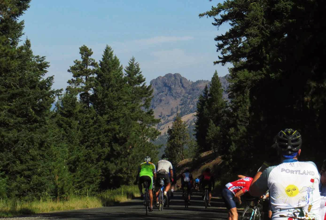
Day seven promised another long climb up a mountain pass. With six days of riding behind me, I actually felt pretty good. At the top, we were rewarded with this view and a long, winding descent. The only thing that made the descent less than perfect: cattle guards, nine of them. A small price to pay for such a beautiful ride.

Near the bottom of the hill, we had a rest break with a great view. This is looking back on the mountain in the picture above.
The last ten miles of the ride took us on U.S. Highway 26, where we had the most traffic of anywhere on the ride. The traffic wasn't anything compared to what we are used to in Maryland, but it was still a lot after being able to ride for hours on rural roads without seeing another car. The three of us were cruising along in a small paceline, just focused on getting to town (and not having to sit on a bike seat anymore), when Michael got another flat. On the bright side, I got to take some great pictures that we never have stopped for otherwise, since all we were worried about was finishing. The Strawberry Mountains are above.
Looking east towards John Day, Oregon and the finish line.
We finished!
Final mileage for the ride.

When planning the end of the trip, I just took the directions from the Cycle Oregon materials for the most direct route back to Portland. We had a flight relatively early in the morning and I figured we'd just get their as quickly as possible. The route wound up being one of the biggest surprises of the trip, just because the amazing views and scenery were so unexpected. It was an area of Oregon I had never seen and I knew nothing about the roads before we were on our way back to Portland.
It started as soon as we turned off of U.S. Highway 26, just 38 miles west of John Day. This is Picture Gorge from a pullout near the John Day Fossil Beds National Monument visitor center (which was, unfortunately, closed for the day). We got a bit of a late start out of John Day, but that wound up being a great thing because the light on the hills was incredible.
Another view of the hills in John Day Fossil Beds near the visitor center.
An irrigated hay field in front of the hills.
We were driving northwest, so it took a very long time for the sun to go down. We wound up chasing the sunset for a couple of hours - probably the longest sunset I've ever seen. West of Condon, Oregon, we came out on a high plateau with a number of wind turbines. While we were stopped, the awesome mechanics from the Bike Gallery in Portland passed us, one of only about half a dozen cars that we saw in several hours of driving.
About fifteen minutes after we stopped for the wind turbines, from the backseat, our friend said, "STOP THE CAR!" This view of Mount Hood was the reward for the slow drive and late departure from John Day. A fitting end to two wonderful weeks in my favorite state. 

Thursday, September 19, 2013

Oregon Chapter 4: Cycle Oregon Days 4-6

Day four of Cycle Oregon was a layover day in Diamond, Oregon (population 5).
Even though no one technically had to be anywhere, people were still up and about in camp really early, so I caught the sunrise. There were a bunch of activities that riders could do, there was an optional ride, or one could just hang out in camp. The only trouble with the campsite in Diamond was that there was no shade and it was going to be hotter than the previous day. 

Since we didn't want to take the vans up to Steens Mountain, we figured we may as well ride. The route description originally gave the option of a 50 mile or an 80 mile ride, both out-and-backs. We were debating the merits of the longer ride at breakfast when another rider said that the route had been shortened. The announcement had been made while we were at the wine dinner the night before. Apparently, a rancher needed to drive 500 head of cattle across the road at mile 24, so the only choice was a 48 mile ride. Sometimes it is nice to have decisions made for you.
Heading out for the morning's ride.
The sign at the turnaround, just north of the cattle drive.
We weren't allowed to get very close to the cattle drive (for good reason), but I was able to catch a few of them.
After the ride, we went back over to the Hotel Diamond for some shade and wifi. Unfortunately, everyone else in camp had the same idea, so we shared the shade and overwhelmed the hotel's wifi. It was a good afternoon anyway. This is the view on the drive over.
Back in camp, Portland-based Community Cycling Center was offering charging services at each overnight stop. Those are cell phones charging in plastic zipper bags, which the staff cheerfully referred to as IV bags.
The solar panels the Community Cycling Center used to power their charging station.
At the end of the day, we went to a star party put on by some of the astronomy clubs from Sisters and Portland. We got to see closeups of the moon and the rings and a moon of Saturn. We also saw the Chinese Space Station transit the sky. The area of Oregon we were in is one of the darkest places in the continental U.S. due its distance from major population centers. 
Day five dawned with a little bit of cloud cover, which was a relief after several days of riding through the high desert in the blazing sun. We had a nice, flat 40 mile ride to Crane, Oregon.
We made a stop at the Pete French Round Barn, which was used to train young horses and keep them in shape during the winter. They would then be ready for work in the spring.
Crane (population 51) was the overnight stop on day 5. Nearly half of the geographic space in town is occupied by the high school. It is likely the only public boarding high school in the U.S. The school district covers 7,500 square miles (for reference, that is more than half the size of Maryland), making it impractical for students on far flung ranches to be bused to school every day. Approximately 100 students stay in dormitories and go home on weekends.
We camped on the Crane High School football field. We noticed two things:  1) The kids still had practice that afternoon, but they had it on the lawn of the local Mormon church. 2) The field doesn't have lights, so they don't play any night games.
One of the amazing things about Cycle Oregon was the showers. Four tractor trailers that had been converted into shower rooms were parked near the campground. Each one of them had two shower rooms with about eight showers in them, complete with hot water. Each trailer also had a set of sinks on what was basically a drawer under the trailer. Getting a shower each night while camping was a really nice luxury.

On Day 6, we rode 73 miles from Crane to Seneca, Oregon. I was feeling really strong by this point, but it would actually turn out to be a very long day for Michael and me.
This was along U.S. Highway 20 east of Burns. It was the only real highway we had to ride up to this point, and it was only four miles. We are climbing towards the mountains and, again, grateful for cloud cover. In spite of the passing lane in the picture, the climbing wasn't too bad.
Just after we turned off of the highway, we got our first glimpse of the mountains to the north. We would have to ride through them later in the afternoon.
And then the flat drama started. Michael got four flats over the course of 12 miles, which added a couple of hours to our trip.
The sag wagon checks to see if Michael has what he needs to get back on the road. Fortunately, we didn't have to ride in the van.
We had one 1.5 mile stretch of gravel on day six, always an adventure on skinny road tires. We finally rode into camp at 4:30 (we started at 8 a.m.). Our friend, once we found him, had picked out a nice campsite and I got a massage that night. Earlier that afternoon, I realized I was having trouble shifting into the smaller cogs on my cassette. One of the mechanics from the Lake Oswego Bike Gallery store replaced my rear derailleur cable and re-adjusted my drivetrain. Not a bad last night on the ride.

Tomorrow, I'll post pictures from the final day of Cycle Oregon and the drive back to Portland.