Monday, May 19, 2014

Utah Part 1: The Paria River Canyon

Michael, a friend, and I spent the last two weeks in southern Utah, camping, hiking and cycling. All of our winter cycling was to prepare us for a week-long cycling trip in the national parks there (more on that in a later post). We flew out to Las Vegas on a Saturday, rented a car, and stayed over in St. George, Utah.

Sunday morning, after a grocery trip, we headed for the Vermilion Cliffs National Monument, east of Kanab, Utah. A few miles southeast of Hurriance, Utah, we stopped for a picture along the side of the road and got the first pleasant surprise of the trip: the desert was in bloom. There were flowers everywhere! I complained all winter about having to train for a trip so early in the year, but the flowers made it worth it. The flowers in the desert don't bloom very long and our trip was timed perfectly. We also got our first glimpse of Zion National Park in the distance.
Zion National Park is on the horizon in the center from Utah State Highway 59 southeast of Hurricane, Utah.
 Red cliffs along US Highway 89A.
Sphaeralcea coccinea (Globe Mallow).

We picked out a beautiful campsite in Whitehouse Campground and pitched our tents. The campground was another nice surprise. I picked it for location alone. It was centrally located for several hikes on our list. It turned out to be tucked in between stunning slickrock walls and the Paria River.
There were some steps carved into the rocks near the parking area of the campground. Michael decided to test them out. I couldn't find any information about how old they are.

As soon as the tents were pitched, we set out for the first hike of our trip down the Paria (pronounced, as I learned, Par-EE-a) River. It was hot - maybe in the 90s - and quite a change from the cool spring we've had in Maryland.
The Paria River, which was only a few inches deep, flows in an open wash for several miles below Whitehouse campground. Eventually, it narrows into a slot canyon, but we didn't make it that far, in spite of hiking for several hours. We spent a lot of time taking photographs and exploring the little side washes.
Salt crystals left behind as the water along the edges of the river evaporates.
Oenothera pallida (Evening Primrose). These were blooming everywhere, not only in the Paria River Canyon, but we saw them for most of the trip.
Michael and our friend exploring a side wash.
These holes were eroded at the base of the canyon walls.
Michael standing in one of the little alcoves.
The entrance to the first slot canyon of our trip. This little side canyon was probably less than 50 yards long, but it was a nice treat to find. Michael is in the center of the photo for scale.
Giant mud cracks back in the slot canyon.
The end of the slot canyon. This was a fun little preview of the hikes to come.
Eventually, we decided that we had to turn back. We were definitely becoming a victim of "let's just see what is around the next bend" syndrome. Everything was so fascinating, we could have continued until the sun went down.
Optunia sp. (prickly-pear type cactus). On the way back, we found several of these flowering cacti. Note: I don't have a great field guide to southwestern wildflowers, so I'm struggling a bit with identifications.
Sceloperus uniformus (Yellow-backed Spiny Lizard). This lizard hung around our campsite trying to impress us with its "pushups." 

Tuesday, April 29, 2014

Browns Hollow Loop: Flowers and Waterfalls

Michael, a friend, and I took a break from cycling this weekend to get out for a nice, long hike. We went out to the south part of Massanutten Mountain in the George Washington National Forest. It was an absolutely beautiful day. We started seeing early spring wildflowers right away. The hike started at the erstwhile Massanutten Visitor Center. We followed an old nature trail down to the Browns Hollow Trail, which slowly climbed up to a saddle between Short Horse Mountain and Big Mountain. Along the way, we saw several very nice waterfalls. We had lunch at the foot of one that was nearly 20 feet high. Since the trail was quite a ways above the creek, it was an interesting scramble down to the falls.

After reaching the top of the saddle, we then lost nearly all of the elevation we gained, only to have to re-climb it on the Roaring Brook Trail. Several steep switchbacks put us on top of Big Mountain, where we had views through the trees. The we descended to the bottom of the next valley to the Massanutten Trail. The Massanutten Trail follows a gravel road in that section. No shade and a steady climb made for a surprisingly warm climb for a spring day. Since it was April, it was pleasant, but it would be a miserable climb in July or August because of the lack of shade.

Eventually, the trail returned to the woods and we were rewarded with a beautiful overlook to the west, only about 1.5 miles from the car. We noted the fact that, in spite of the proximity to the road, there was very little trash and no graffiti. When we finally left the overlook and continued on our way, we found out why. It is, indeed, only about 1.5 miles from the road, but it is a tough, steep, rocky climb. We didn't mind, since we only had to hike down it.

Massanutten is one of the unnoticed areas to hike around here. We saw one group of backpackers and one lone hiker. It was a really pleasant hike that I definitely would do again.
These Viola pedata (Birds Foot Violets) were right along the trail.
We startled an Eastern Fence Lizard (Sceloporus undulatus). Eastern Fence Lizards blend in with tree bark really well. Click to enlarge.
 A fiddlehead along the trail.
This is the 20-foot waterfall, although it doesn't look like it in this picture. It was tough to get an angle that showed the scale.
 A butterfly (I don't know the species) on Mountain Laurel on top of Big Mountain.
The Massanutten Trail follows this gravel road for a few miles. At this point, we were fairly high, so the trees hadn't begun to leaf out. Everything is several weeks behind where it has been in the last few years. I've been out this time of year and the entire canopy had grown in, but this year, it was basically still winter up here.
 The craziest thing we saw along the trail were these massive ant hills. You can see my hiking pole in the bottom of the photo for a little bit of scale. This thing was easily four or five feet in diameter and two feet high. There were ants everywhere.
 A close-up of the ants (you'll have to enlarge the picture to see all of the ants).
 A bootshot from the overlook. This is looking west towards Great North Mountain.
 Michael at the overlook.
 Uvularia puberla (Mountain Bellwort). This one was a new species to me.
Allium tricoccum (Ramps). We saw these along the way as well, which was a big surprise, since I generally associate them with higher elevations. Any guesses? I'll post the answer later this week.

Friday, April 25, 2014

Garden Update 3: Flowers

The garden is coming right along now that it has warmed up a little bit. Flowers are starting to bloom and we've been harvesting asparagus and radishes.
Geranium maculatum (Wild Geranium). I planted these last year in front of the house and they are doing really well.
 Little grape hyacinths along the street.
This little bee was hovering around while I was taking pictures of the flowers.
 Our azaleas are starting to bloom.
There's a guy where I work who breeds his own azaleas. When I came in on Wednesday, he asked if I wanted a few of his hybrids. I wound up with 20. They are all about two inches tall and he said he has no idea what color they will be. Pretty cool! We aren't sure where all of them will go yet.
One of the larger tomato starts. They are hardening off outside now, but it is still too cold for them to be out overnight.
We are growing potatoes in bags again. We are trying out the 59 cent blue Ikea bags since various people on the interwebs seem to have had success with them.
A couple of the pepper starts.
Our first radishes are coming in. These are French Breakfast Radishes.

Tuesday, April 15, 2014

Cycling in a Heat Wave and Spring Flowers

The training continued this weekend with a ride out of Meyersville, Maryland. We've done the shorter (55 mile) version of this one before. This time, we intended to do the 75 mile version and we did come close. The weather and a lack of water conspired to cut our ride a couple of miles short. The weather was absolutely beautiful, but it was really warm compared to what we have been riding in. I had to ride in tights earlier in the week, so it was a bit disorienting to ride in 80 degrees.
We took a break at the parking lot which is the northern terminus of the Catoctin Trail. In spite of the good weather, there weren't any cars in the lot.
This sign, which I had never noticed before, is right beside the parking lot. The previous times that I've been to the parking lot, it was in the summer, so I think it was covered by leaves and undergrowth.
The part of the loop that was new to us took us north, into Pennsylvania's Michaux State Forest. It was a really nice road, through beautiful pine woods. We stopped for lunch at a pulloff next to this stream. From here, the road climbed steadily for six or seven miles. Here's where the adventure started.

By the end of that climb, we were all getting pretty low on water. The cue sheet indicated a store just after the top of the climb, which turned out to have gone out of business. We checked and decided we could make it to Pen Mar Park, where we had gotten water in the past. We arrived, completely out of water after a grueling, hot, windy climb, only to find that the water had not been turned on yet for the season. They had a vending machine, which must have been empty. It taunted us with pictures of cold water bottles as we tried to put money in it. Normally, after stopping at Pen Mar, we ride up to High Rock, a couple of miles up the road. The prospect of more climbing with no water didn't appeal to any of us, though. We knew of a gas station a few miles down the road (and all downhill) from a wrong turn on a previous ride, so we decided to skip the short climb up to High Rock and head for water. We must have sat in front of that gas station for half an hour, draining a gallon jug of water and cooling off.
Later in the ride, Michael spotted these Sanguinaria candensis (Bloodroot) in a ditch along the road. These are the first wildflowers we've spotted this year. They provided me a nice morale boost on the last leg of the ride.
These Tussilago farfara (Coltsfoot) were nearby.

Friday, April 11, 2014

Garden Update: Spring!

Spring suddenly arrived this week. A few days ago, everything was still pretty brown. Then, all of a sudden, flowers are blooming everywhere and the garden is showing signs of life.
 My Bleeding Hearts were just coming up last week. I was happily surprised on Wednesday to see that they suddenly bloomed.
 One of the daffodils just opening up.
Purple asparagus coming up.
A kale sprout in the cold frame.
 Fennel.
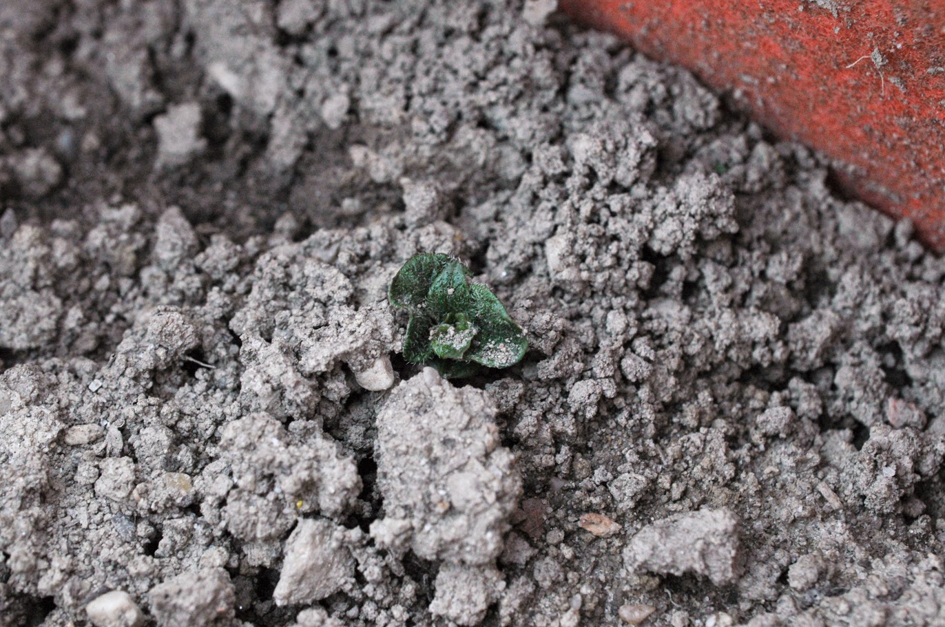
A tiny potato sprout in one of the potato grow bags.
Lettuce starts inside. They are getting hardened off and will go outside this weekend.
A Cherokee Purple Tomato inside. These are starting to spend some time outside, but they still can't go out for several weeks.

Monday, April 7, 2014

Rappelling at Annapolis Rocks

We spent Sunday with Wild Type and another friend at Annapolis Rocks on the Appalachian Trail in Maryland. We arrived early so we would beat the crowds and actually get a spot in the parking lot on US Highway 40. It was cold, below freezing, when we arrived at the parking lot. Sub-freezing temperatures don't bother me in months like December, January, February, etc. It is April now, however, and I'm ready for a few days where the temperature reaches the 70s. There's no sign of spring yet in the mountains.

It is a quick two-mile hike up to Annapolis Rocks. The climb over Pine Knob was a welcome way to warm up. We arrived at Annapolis Rocks, which is usually quite crowded, to find we had it to ourselves. People filtered in and out during the day, but overall it wasn't particularly busy. The temperature eventually climbed enough that it was comfortable without coats and we had a great day playing on the rocks.
Michael getting ready to take the first descent of the day.
 Looking southwest from one of my descents.
 Rappelling down the first pitch.
 Michael demonstrating the value of the autoblock.
Michael watching Wild Type on the second pitch. This one was a lot higher than the first one.

 My shadow on the rocks and a bootshot on the second pitch.
 Looking down at the ground.
 And back up to the top.
 Interesting lichens on a rock.
Michael carrying both ropes on our way out. 

Saturday, April 5, 2014

Quick Skyline Drive Pictures

Just a few quick pictures from our ride today:
 I've ridden by this tree at milepost 20 dozens of times. Today I finally stopped to take a picture of it.
 Massanutten Mountain to the west of Shenandoah National Park
Looking south from Gooney Run overlook towards Hogback Mountain.

I'll have another post this week and an update on the garden.