Tuesday, January 28, 2014

Snowshoeing in West Virginia: Blackwater Falls and Dolly Sods

We spent the weekend at Blackwater Falls State Park in West Virginia with several friends from Old Rag Mountain Stewards. The state park has wonderful cabins that are practically a steal to rent, especially when divided by a crowd. We booked the cabin a while ago for a weekend of snowshoeing and good food. Two weeks ago, we were worried that there wouldn't be any snow at all, but we arrived at our cabin to find a foot of the lightest, fluffiest, driest powder that I've seen east of the Rockies.
Friday afternoon, we went down to Blackwater Falls was mostly frozen. The reddish color in the ice and in the water is tannins from the cedar forests surrounding the river.
Icicles near the falls. I really liked the patterns in the ice.

Friday evening, we headed over to the town of Thomas to the Purple Fiddle for dinner, a band, and some incredible people watching. The band was pretty good, if not my style of music, but the people watching was priceless.

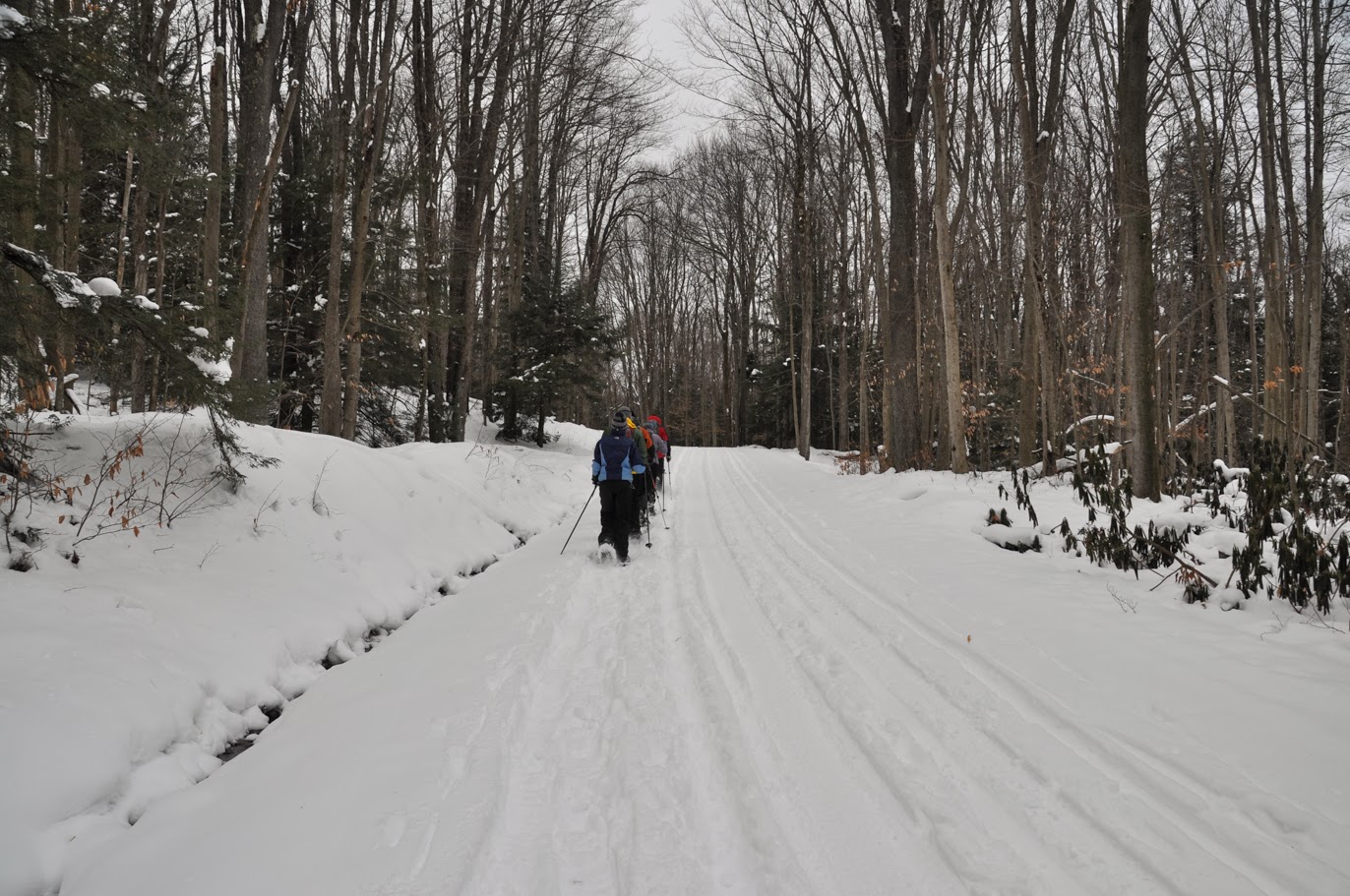
We spent Saturday snowshoeing all over Blackwater Falls State Park. The high for the day was only around 20 degrees and the wind got progressively stronger as the day went on.
We followed the Canaan Loop Road to Lindy Point Overlook.
The Blackwater River canyon. The wind at the overlook was enough to take my breath away.
The curling bark of a paper birch tree.
 Michael breaking trail through fir trees.
The snow really picked up in the afternoon. It was cold enough that the trees popped and cracked as we hiked through the woods.
Balancing Rock in Blackwater Falls State Park. This isn't a great photo, but there isn't really a place to get a nice clear shot of the rock formation. Nonetheless, it was worth the hike to it.
At the end of the day, the group humored me by parking at the lodge so I could run down the Elkala Trail to see Elkala Falls. We ran into a couple we had seen near Balanced Rock earlier in the day. We chatted with them and mentioned that we were going to see the waterfall, to which they responded, "There isn't any waterfall." I pulled out my map, which showed that the falls were right by the bridge that we could see and that the couple had just walked over. They shrugged and continued on their way. We walked out onto the bridge, looked down, and there were the completely frozen falls. It took some work to get down to them and get the shot from below. Let's just say it was good to have traction devices.

Sunday, we headed for Dolly Sods, which is one of my favorite places to hike in the winter. We made the climb up the ski run in good time, getting a few funny looks from people who had the good sense to ride a lift to the top of the mountain. We started out in the sun, but by the time we reached the entrance to the wilderness, it was snowing again. It is a little strange to stand on the edge of the run, watching the crowds of skiers and snowboarders go by, then turn around and walk twenty yards into the wilderness area and a completely different world. 
The entrance to Dolly Sods Wilderness. No one else had been up there that morning, so we had untracked snow and complete solitude.
Michael making hot drinks for lunch.
Dolly Sods can have frightful weather. On Sunday, we experienced freezing cold (maybe twenty degrees), gale force winds, and lots of snow - some of it fell from the sky and some of it was just blowing around. It was hard to tell which was which sometimes. We plowed through drifts over our knees in places. When we finally turned around, we found a lot of our tracks and been completely covered by snow, even though we had only been there less than an hour before.
 Later in the afternoon, the sun did try to come out.
The trail through some cedars. We decided this would have been the perfect place to camp since it was sheltered from the wind.
 Looking west across the Canaan Valley. We got just a sliver of a sunset in the distance, beyond the clouds.
A friend of ours hiking along the ridge.
Breaking trail out in the open.
Blowing snow on the western edge of the ridge in Dolly Sods. I was just a little bit sad that we weren't camping out. It was such a beautiful day and there was so much snow that I wanted to spend more time out there. Unfortunately, we all had to get home for work on Monday. 

Sunday, January 19, 2014

Long Mountain: Bushwhacking in the Snow

Yesterday's hike started from the Trout Run trailhead along Trout Run Road in the Great North Mountain area of the George Washington National Forest. This area is just over the border into West Virginia, near Big Schloss. There was about an inch of snow on the ground at the trailhead. It was also cold, around 18 degrees. Our party included two dogs, who were very, very happy about the snow. One of them started his hike by doing barrel rolls in it. We crossed Trout Run on a nice footbridge and then began the climb up to the top of Cherry Ridge. The snow got a little deeper as we climbed, but not too bad. Every time the wind blew snow up my pant leg I repeated my wish that I had remembered my gaiters. 

We made good time getting up and over the ridge and soon enough, we reached the point where we needed to leave the trail and begin the nearly 2.5 mile bushwhack over Long Mountain. Since that spot was relatively sheltered from the wind and it was sunny, we took a standing break for lunch. Before long, though, everyone was cold and it was time to move on. 

The first 100 yards of the bushwhack were tough. The area had been cleared relatively recently, so it was pretty overgrown with small trees and shrubs. Once we pushed through that, the forest opened up and travel became a lot easier. We meandered our way up the ridge, aiming for a rock outcrop called Dog Rock. I suspect we meandered a bit too far southeast and I am not sure we made it to Dog Rock itself. The ridgeline of Long Mountain is dotted with outcrops. None of them, from what we could see, stand out as distinctive from the others. We had a nice view through the trees, though, given the wind, we didn't linger. We descended a steep gully, happy that it was free of snow and meandered generally east through the woods towards Trout Run Road. 

At the bottom of the valley, we followed an old road bed, which paralleled Trout Run Road. The idea was that we would be able to spot a gravel road on the other side of Trout Run Road (which we could see) through the trees. With the snow, we completely missed it and wound up at the boundary of some private land. At that point, we decided to walk back up the Trout Run Road so we wouldn't miss it again. It turned out that we had only missed it by a hundred yards or so. 

Back on trail, we made great time on the last half of the hike. Towards the end of the hike, we saw one other hiking party - the only other people we encountered the entire day. We arrived back at the car right at dusk. It was a cold, beautiful adventure.

Trout Run at the beginning of the hike.
Michael hiking up the Long Mountain Trail above Trout Run.
The junction of the Long Mountain Trail with a fire road.
A small stream on the east side of Long Mountain.
A clump of snow caught in the needles of a White Pine.
Hiking up the untracked Half Moon Trail.
Sunset near the end of the hike on the Bucktail Cutoff Trail.

Thursday, January 2, 2014

New Year's Day on Big Schloss

We spent New Year's Eve with two friends at a cabin near Strassburg, Virginia. After a night of good food, cards, and hilarity, the four of us were a bit slow to get around on New Year's morning. We made it to the Big Schloss Cutoff trailhead around 12:30. For the first of January, we couldn't have asked for better weather. It was sunny and in the 40s.

Our intent was to hike both Big Schloss and Tibbet Knob as an out and back, which would mean finishing in the dark. We made good time hiking up the cutoff trail to the top of the ridge, where we ate a little bit of lunch. From the junction with the Mill Mountain Trail, we turned south and hiked to the top of Big Schloss. There were a few people on top of the outcrop, including a group of five or six mountain bikers. We found a nice spot in the sun and took a break for food and pictures. Since we had a long way to go, we soon returned to the Mill Mountain Trail and continued south, towards Wolf Gap. After a brief climb up a small peak on the ridgeline, the trail makes a short, but steep descent to Wolf Gap Campground.

At that point, it was almost 4 p.m. Tibbet Knob would have added three miles, round trip, to our hike and we had about 90 minutes of sunlight left. We opted to turn back. On the way back to the car, we got a couple of nice views of the sunset and of Big Schloss in the fading light. Even with that, the last hour of our hike was in the dark. A great start to the New Year: 10.5 miles of good hiking.

The Big Schloss Cutoff Trail at the junction with the Mill Mountain Trail.
Looking south down the Trout Run Valley. Tibbett Knob is the peak just to the left of center in the photo.
Bootshot from Big Schloss.
Our friends and Michael on Big Schloss.
The wooden bridge on top of Big Schloss. I can't imagine the logistics of getting the materials up to the top of the outcrop, let alone building it.
Distance sign at the Wolf Gap trailhead.
Looking east at sundown.
Big Schloss from the south.
Lichens on a rock outcrop.
The Mill Mountain Trail at sunset.

Sunday, December 22, 2013

Winter Solstice Cycling

The weather was incredible yesterday: highs in the 60s and mostly sunny. I almost had to check the calendar to remember that it was, actually, the winter solstice. Michael, a friend, and I headed for Skyline Drive for what could be considered either a very late training ride for this year or a very early training ride for 2014. Either way, it was a beautiful, warm, nearly traffic-free day in the park.
 Looking southeast from the Range View Overlook around milepost 17.
My bike taking a break and enjoying the view of Compton Peak from the Gooney Run Overlook.
Ice on some cliffs near milepost 11. There was still quite a bit of snow in the ditches along the road, particularly in shady areas, but it was melting quickly.

Tuesday, December 17, 2013

Snowy Antietam

Horizontal Tread invited Michael and I up to Antietam National Battlefield for an afternoon on snowshoeing on Sunday. While we didn't get any snow to speak of, they had 4-6 inches up there. That is just barley enough snow to use the snowshoes. In a perfect world, it is nice to have a foot of snow for snowshoeing, but we can't be too picky in the Mid-Atlantic. Opportunities to use them without driving three hours don't come along even every winter.

When we left the DC area, it was 45 degrees and sunny. I thought I would be snowshoeing in my base layer. It was colder in the Sharpsburg area, which wasn't a surprise, but the moment we arrived at Antietam, it clouded over and the wind picked up. I wound up needing a coat for the whole hike. We started on the the north side of the battlefield and made our way south across the cornfield. We passed several farms and stopped to have lunch on the porch of one of the houses that are part of the national battlefield.After lunch, we headed south, pausing to climb the Tower and then further south, all the way to Burnside Bridge. By the time we made it back to the car, the mood was up and the sun was below the horizon. One of the cool things about this hike was that we weren't really following any trails. We just set out across various fields, generally aiming for the next stop. 

Horizontal Tread was a great tour guide, providing context for what we were seeing. I don't know enough of the details of the battle to get into it beyond noting that more soldiers (on both sides) died that day than in any other single-day battle in the Civil War. Almost a quarter of the troops involved in the battle perished. A detailed account of it can be found here

 Looking southwest towards the observational tower, which was built in 1890.
One of the cannons in the Cornfield.
 A directional plate in the observational tower.
A dried seed pod in the snow.
Horizontal Tread (left) on interpretive duty.
 A snowy field in the late afternoon.
 Burnside Bridge.
A Red Bellied Woodpecker in a Sycamore Tree (click to enlarge).
 Monuments near the visitor center in the setting sun.
Moonrise over the fields near the visitor center.

Sunday, December 1, 2013

Third Annual Hike Off the Pie: Bushwhacking the North Side of Old Rag

For the third year in a row, I celebrated Black Friday with an epic hike with my friends from WanderMindfully and Horizontal Tread. This year, we added two additional Old Rag Mountain Stewards to make a party of five. This year's hike didn't involve much walking on actual trails, except on the way back down. We explored the north slope of Old Rag, looking for old cabin sites. The valleys around Old Rag had been settled over 100 years before Shenandoah National Park was created. Evidence of those farms and villages can be found throughout the park. Most trails in the park pass stone walls, house foundations, and rock piles left from cleared fields. Old Rag is no different. Exploring another side of the mountain seemed like a perfect way to spend the day.

Friday was sunny, but cold (although, not nearly as cold as last Sunday). We arrived to find this, much to our surprise:  
We actually had to park in the back of the parking lot. We didn't really expect very many people to be out on a chilly day when most people are focused on standing in line at the mall. I guess our party wasn't the only one who opted out of the crazy. 

We made the easy walk up the road to the trailhead and then crossed the high water bridges before leaving the road. It rained hard on Tuesday and Wednesday, so crossing Brokenback Run proved to be a challenge, but we all made it across with dry feet. From there we followed old road beds, game trails, and sometimes made our own path up the mountain. Way back in the woods, high up on the north slope of Old Rag, we ran into two guys who were camping. They were definitely as surprised to see us as we were to see them. We chatted for a minute and continued our explorations. Higher up on the slopes, a light dusting of snow covered the ground. We saw a lot of evidence of the large fire that swept over the mountain in the year 2000. The ground in many places was scattered with artifacts of those who lived there before the park existed. We emerged onto the Weakley Hollow Fire Road just before sunset, much to the surprise of some downward-bound hikers. We arrived back at the car just as darkness fell.
 Crossing Brokenback Run on a log.
Part of a chimney is all that remains of a cabin high up on Old Rag.
A broken crock.
Snow on the leaves.
A large stone wall along Brokenback Run.
A walled in spring. Springs were often used to keep food from spoiling before refrigeration.
 A seed pod from a Frasier Magnolia (Magnolia fraseri).
Old Rag through the trees.
If you enlarge this one, you'll see an old road bed through the trees.